
The Jetty
Normandy |
France –
2015
Client
Syndicat mixte Baie du Mont-Saint-Michel
Start of construction
04 | 2011
Size
1 841 m
Construction budget
31 M€
Competition winner
2002
Completion
02 | 2015
EUMies Award 2015, nomination
Wood Construction Award Region Lower Normandy 2015
National Wood Construction Award 2015
Trophées Eiffel Steel Construction Award 2015
Equerre d’Argent 2015, category bridges
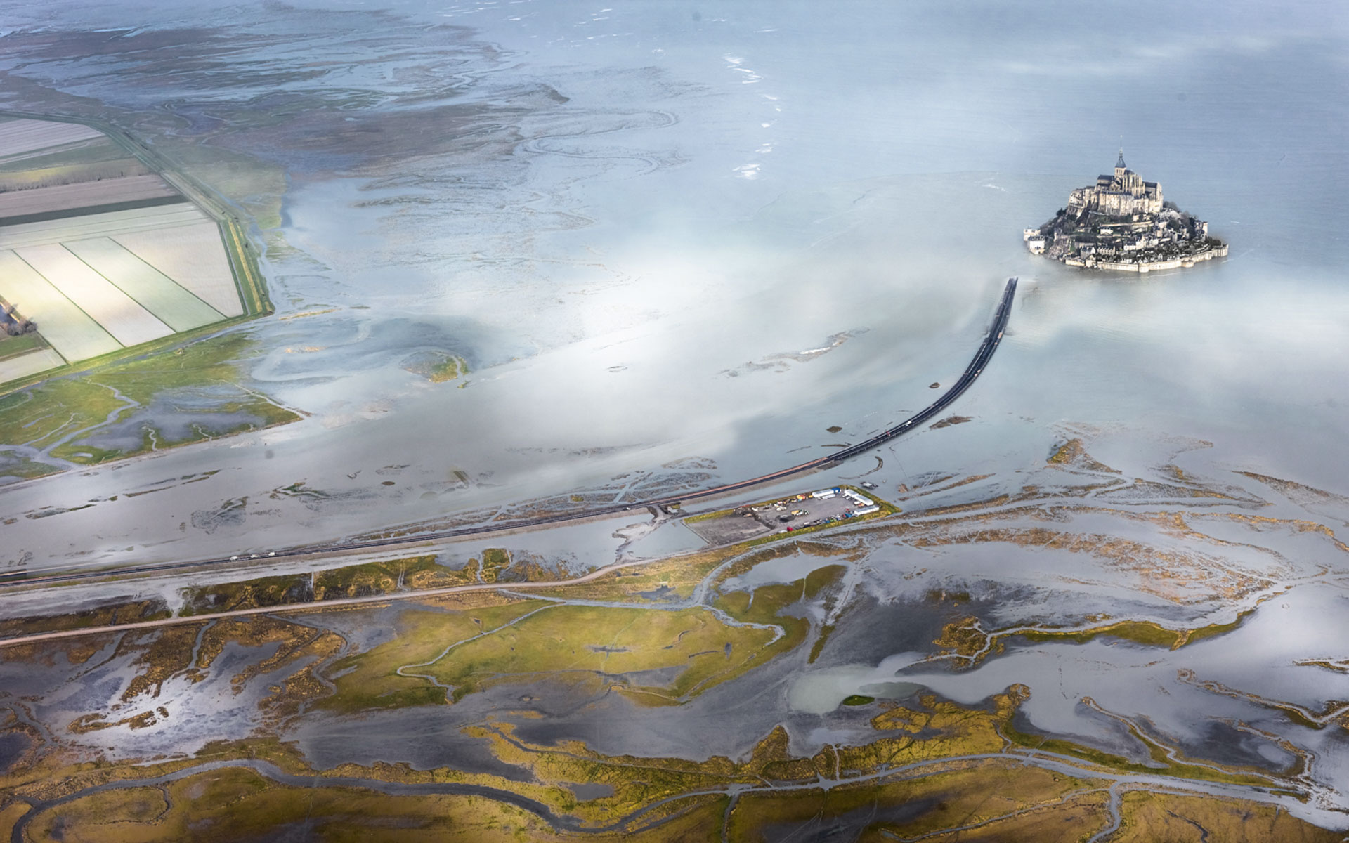
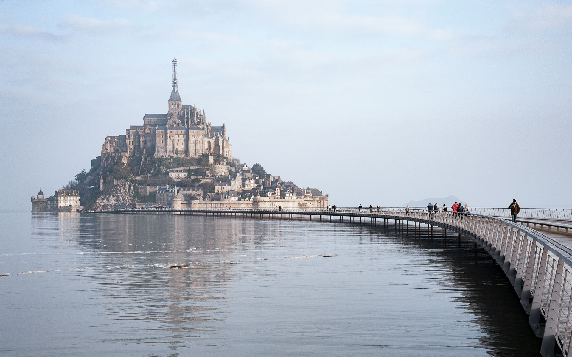
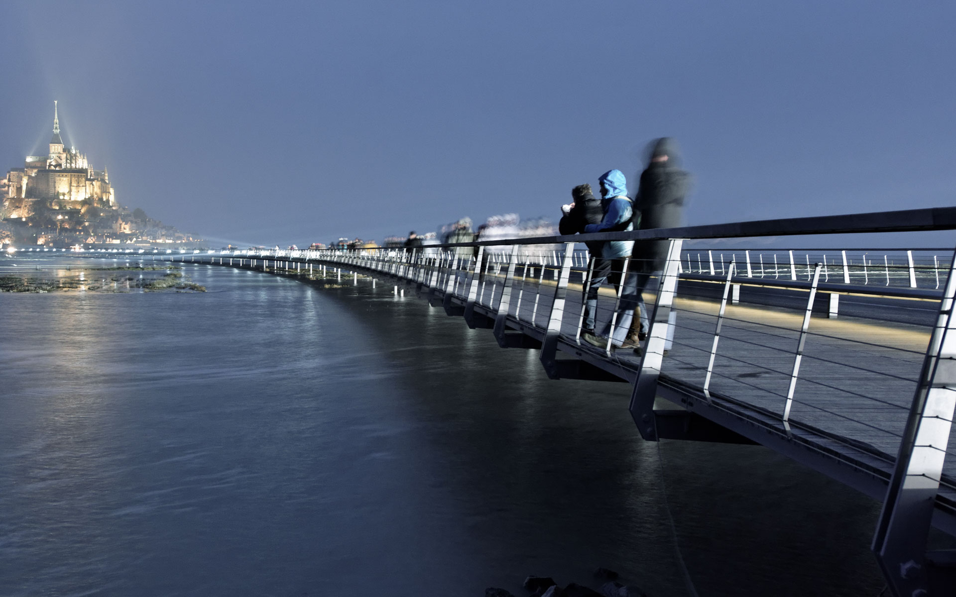
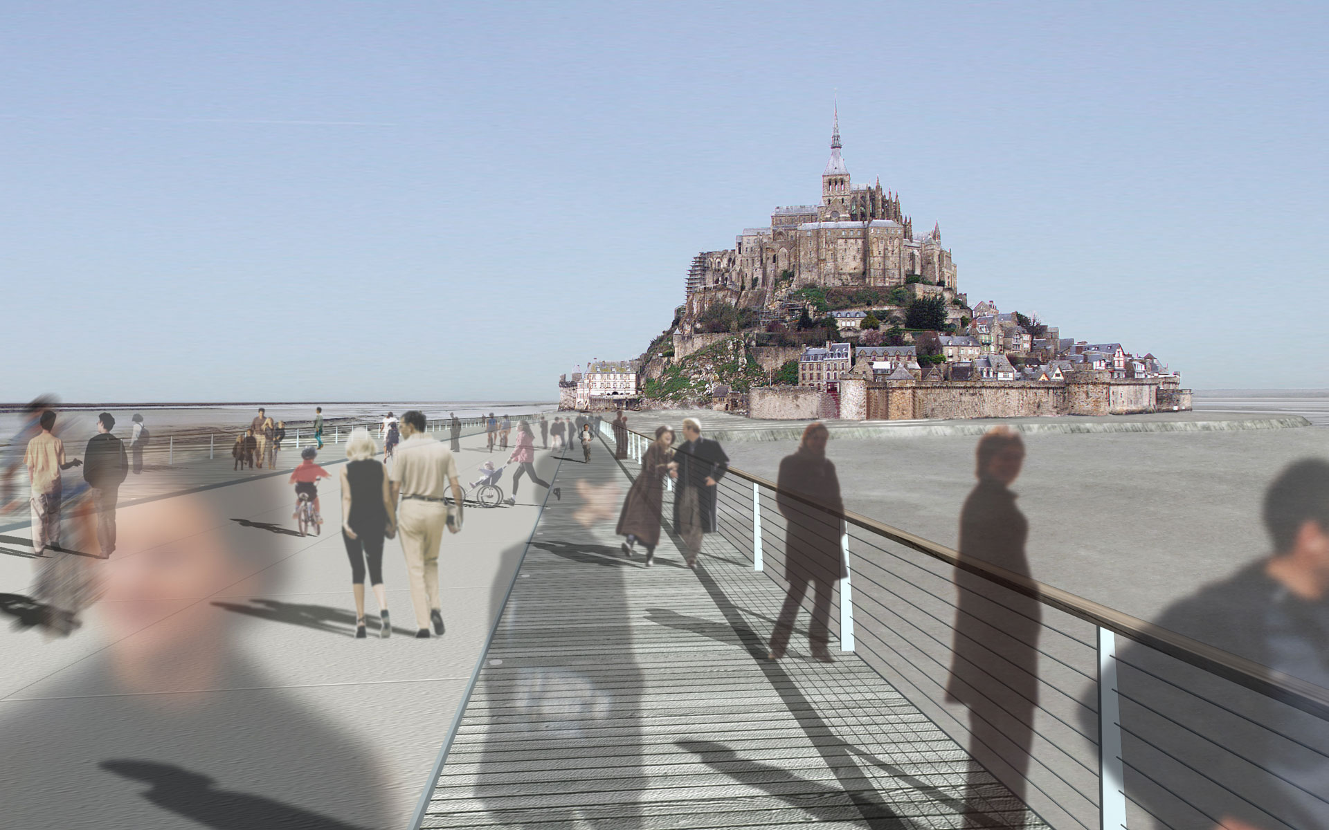
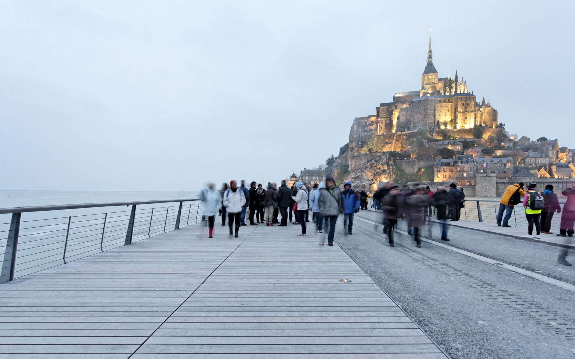
“Walking on Water”
Creating a new access point to a cultural monument and one of Europe’s most remarkable landscapes presents a rare challenge in bridge design.
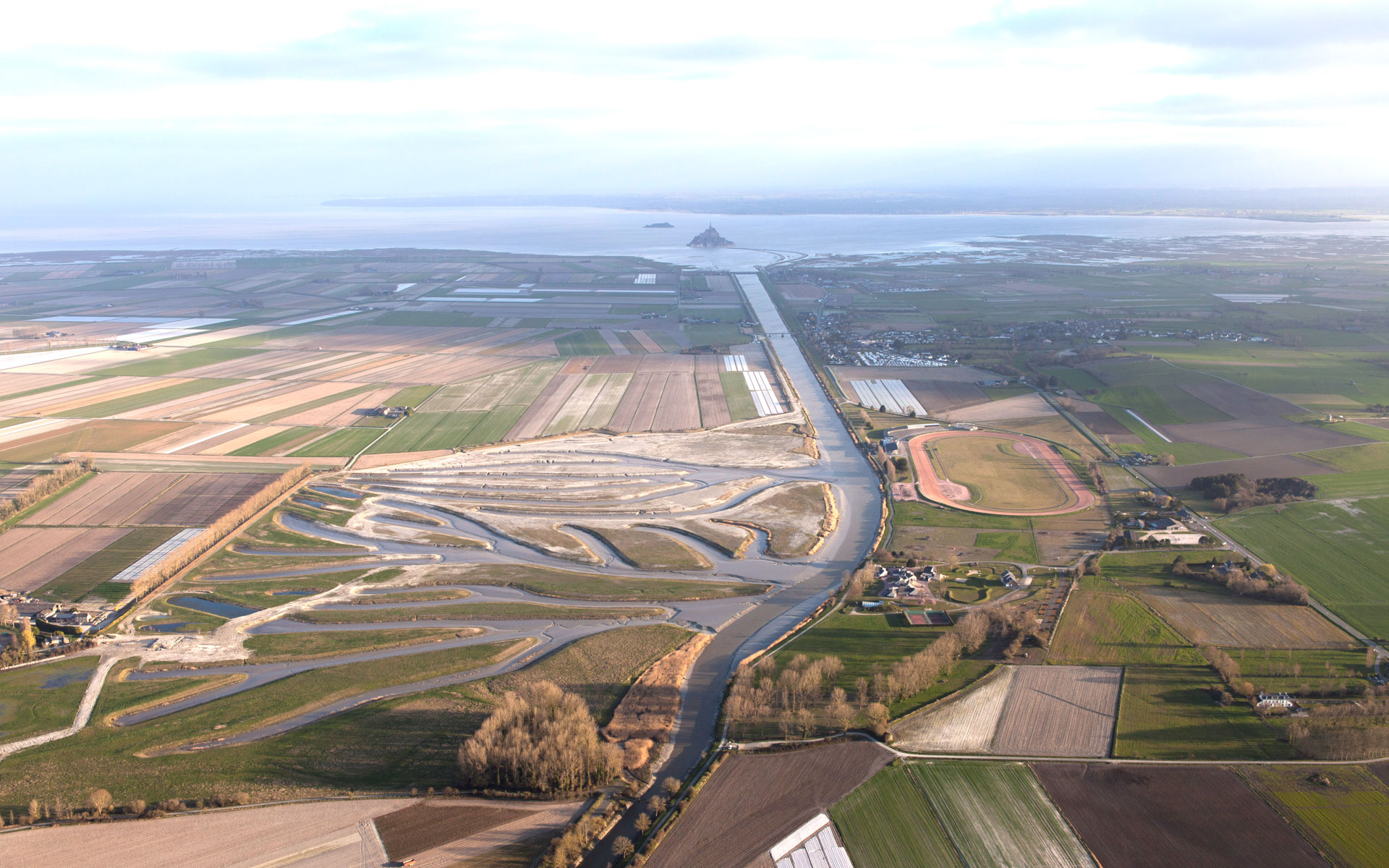
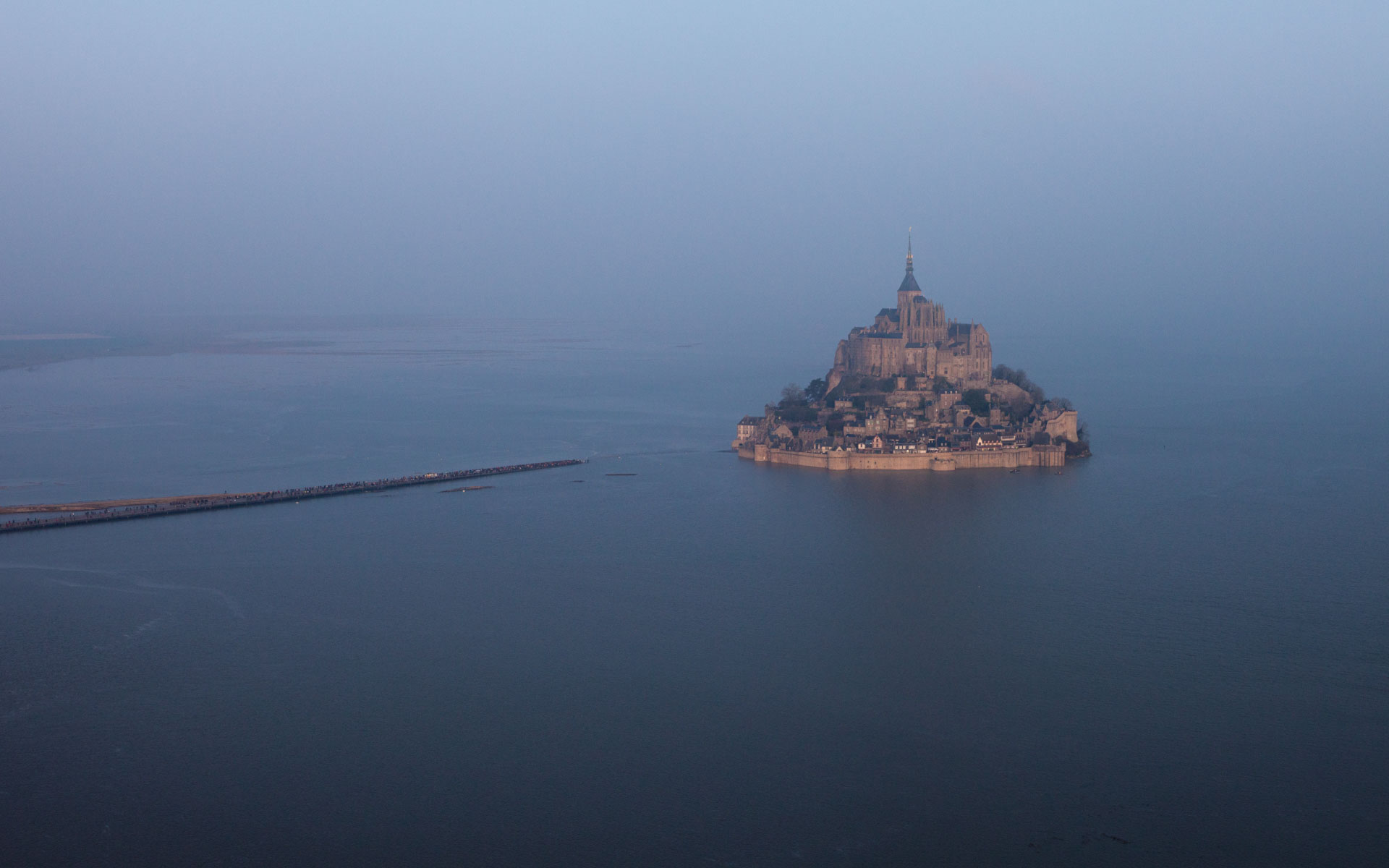
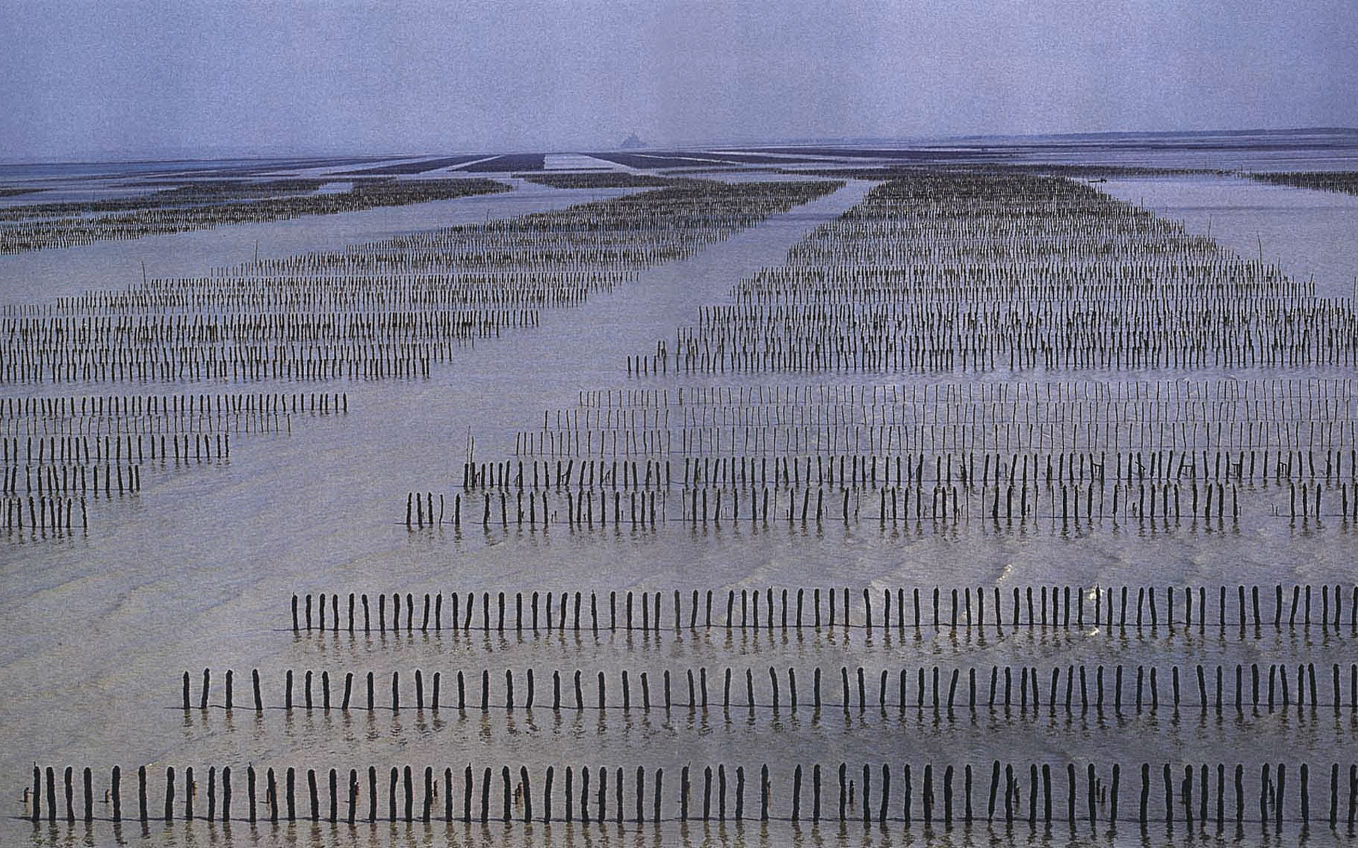
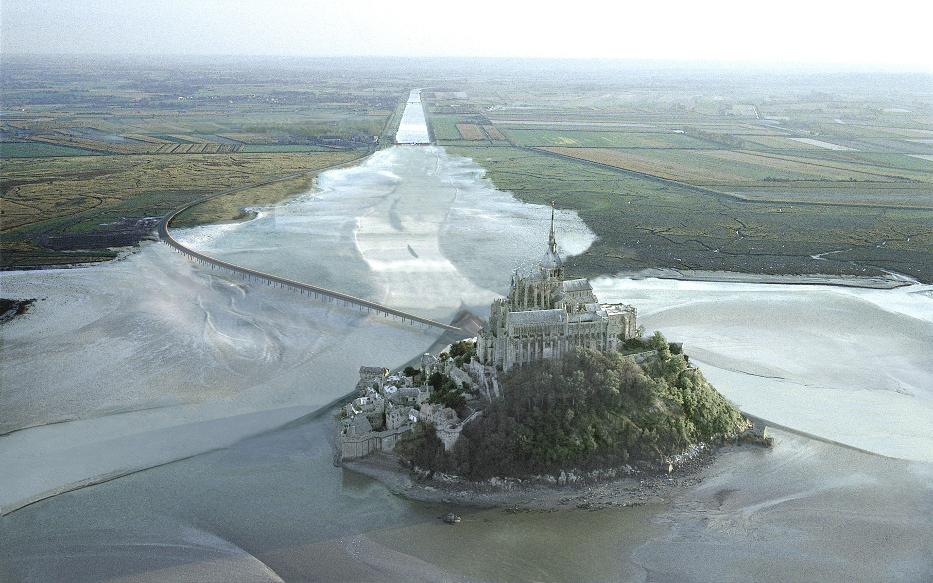
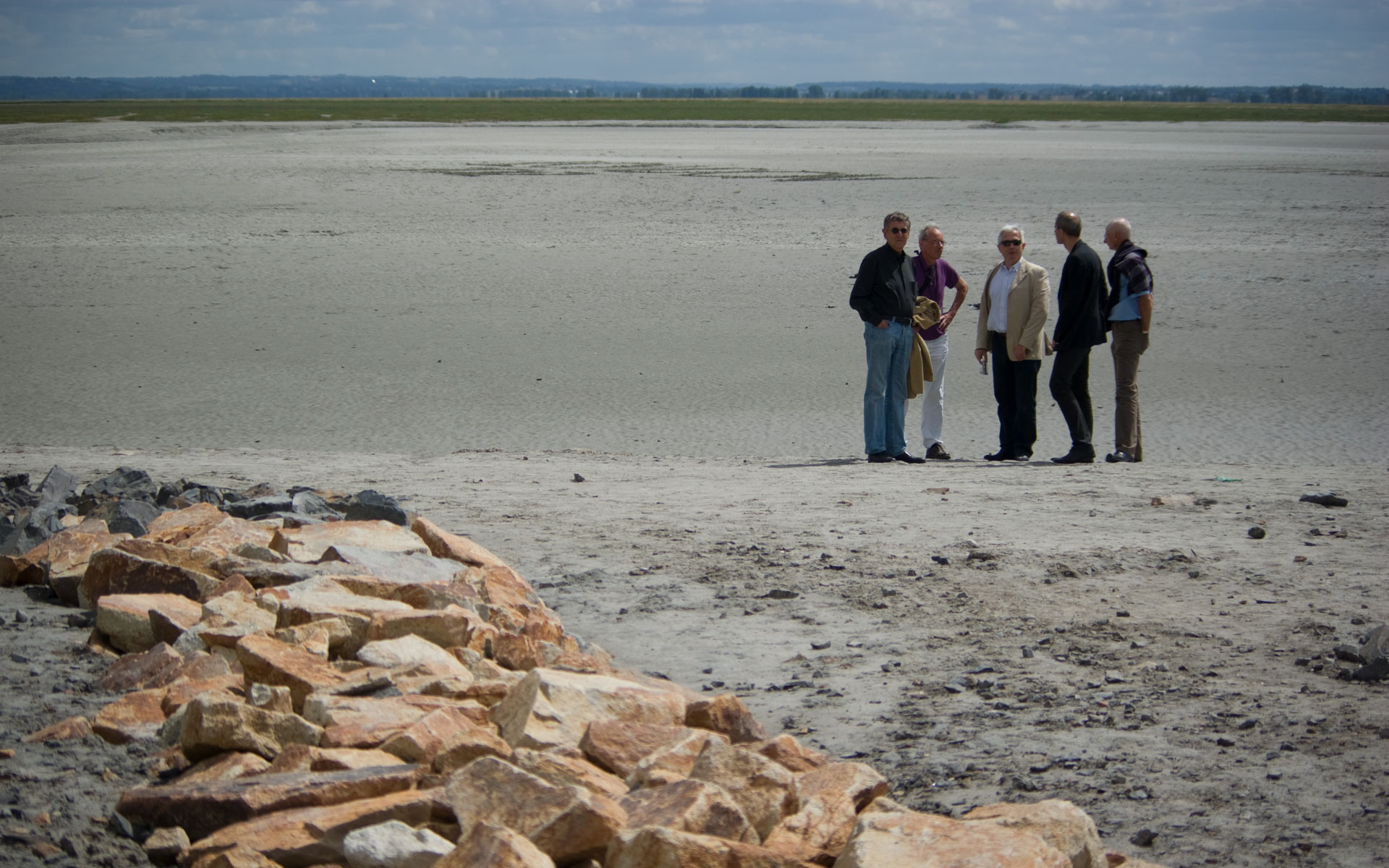
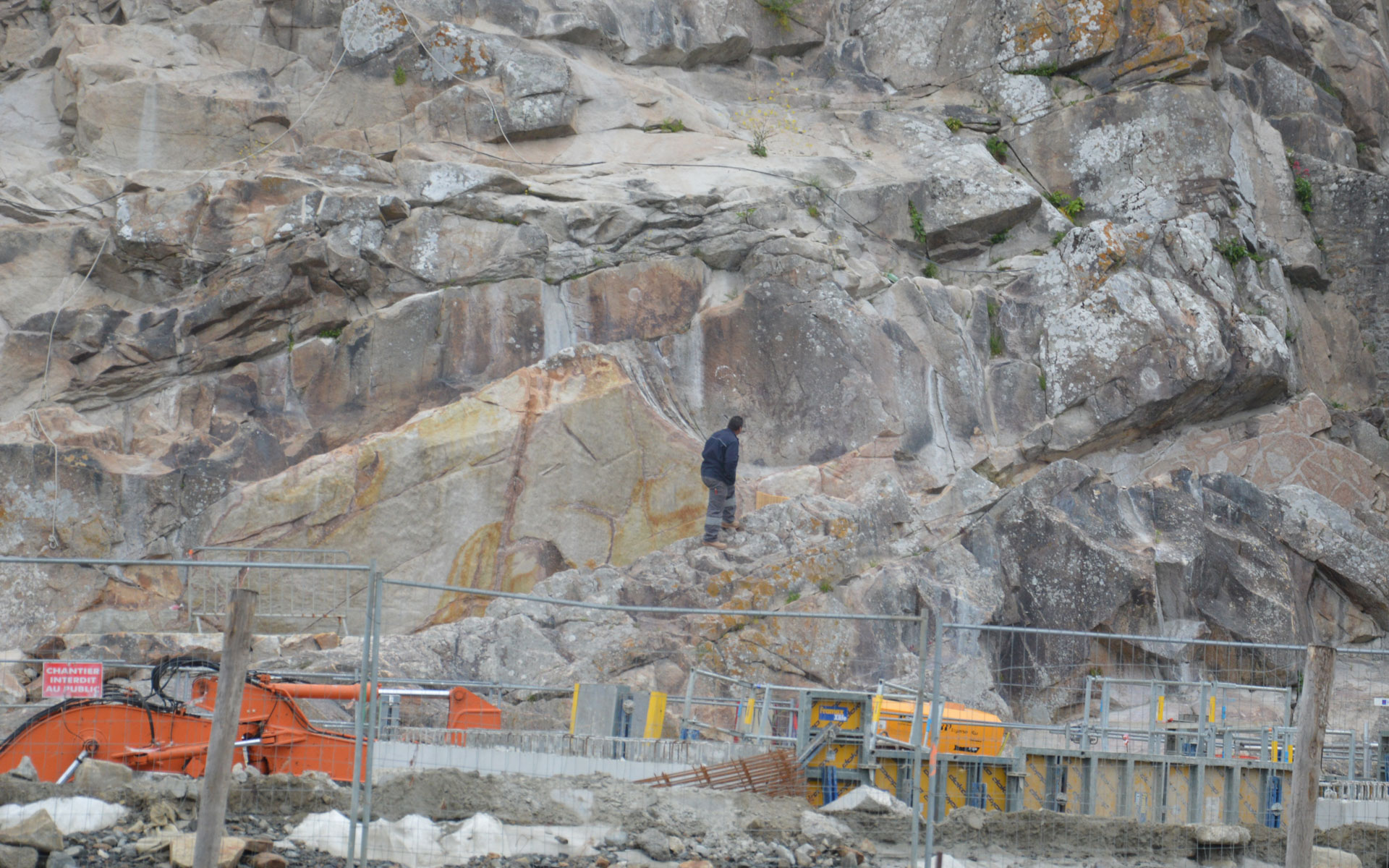
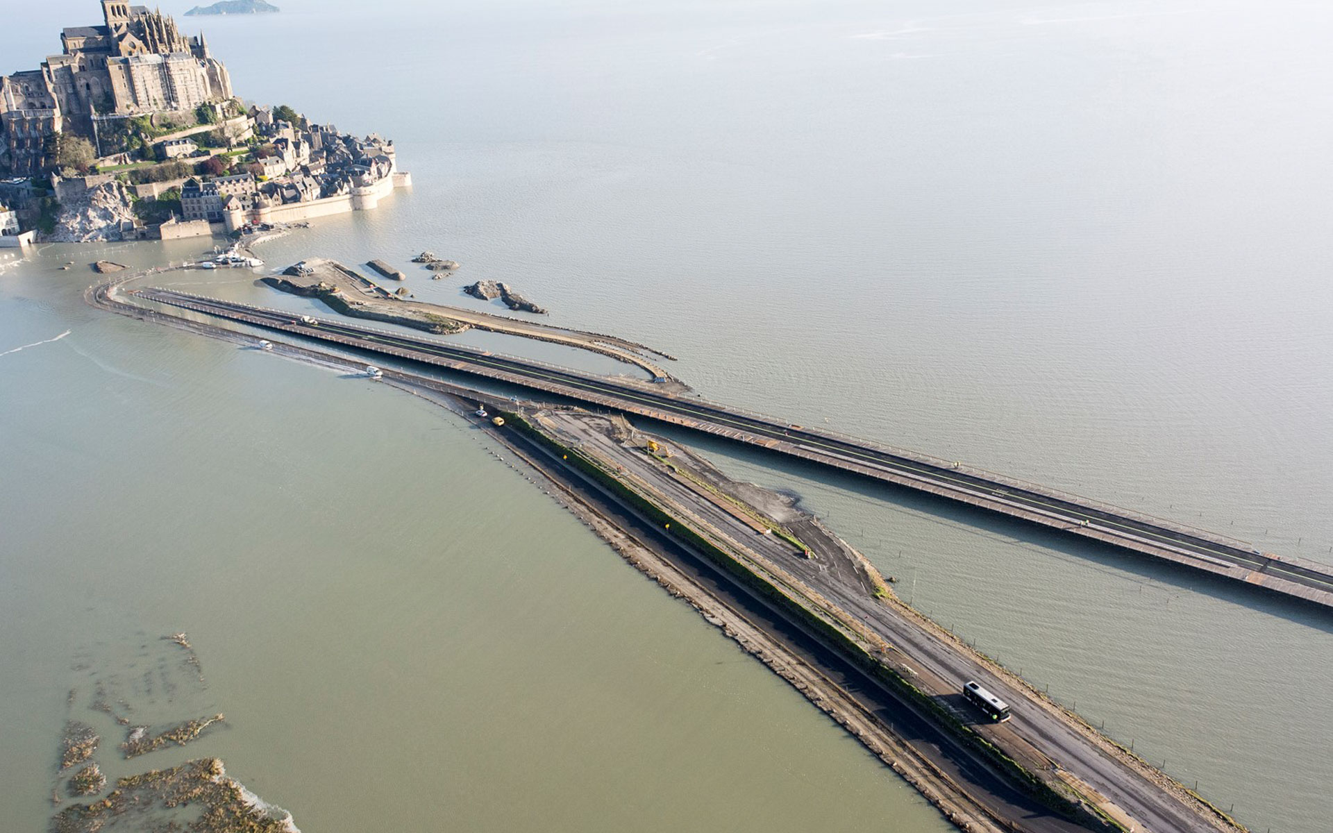
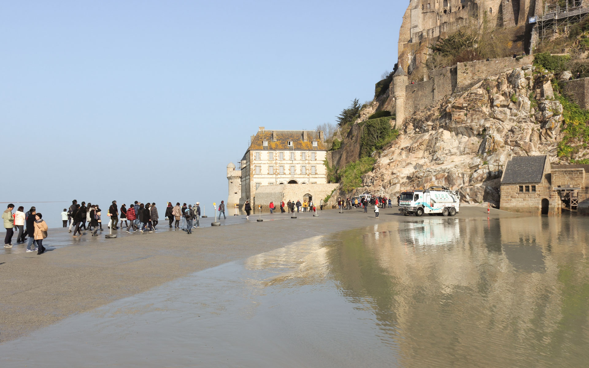
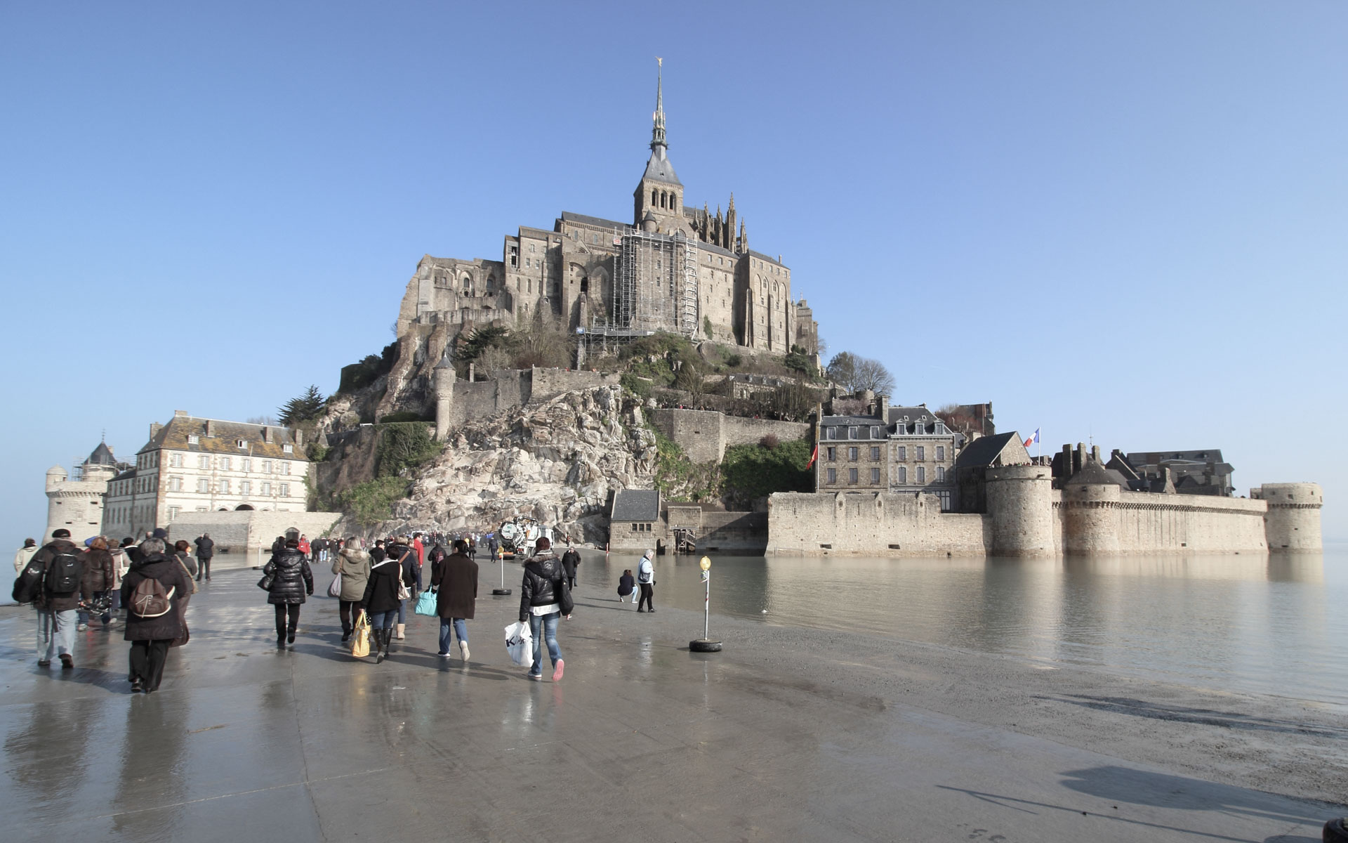
The estuary of the Couesnon River and the bay surrounding Mont Saint-Michel impress with the immensity of the site, its vastness, the beauty of the light, and the colors of the natural elements. The dramatic tidal range of 14 meters exposes the forces of nature and offers diverse landscapes—a vast beach stretching to the horizon alternates with a flooded bay, with only the Mont serving as an island.
Human intervention in the context of Mont Saint-Michel is delicate. The creation of a tide-protected access route aims to provide a safe pathway for visitors while allowing the natural flow of water around the island. This radical change enhances the magic of the place. The minimal slope of the estuary and one of the world’s largest tidal differences accentuate the phenomenon: “the sea rises at the speed of a galloping horse,” as Victor Hugo described it.
The Contrasting Natural Site and Human Impact
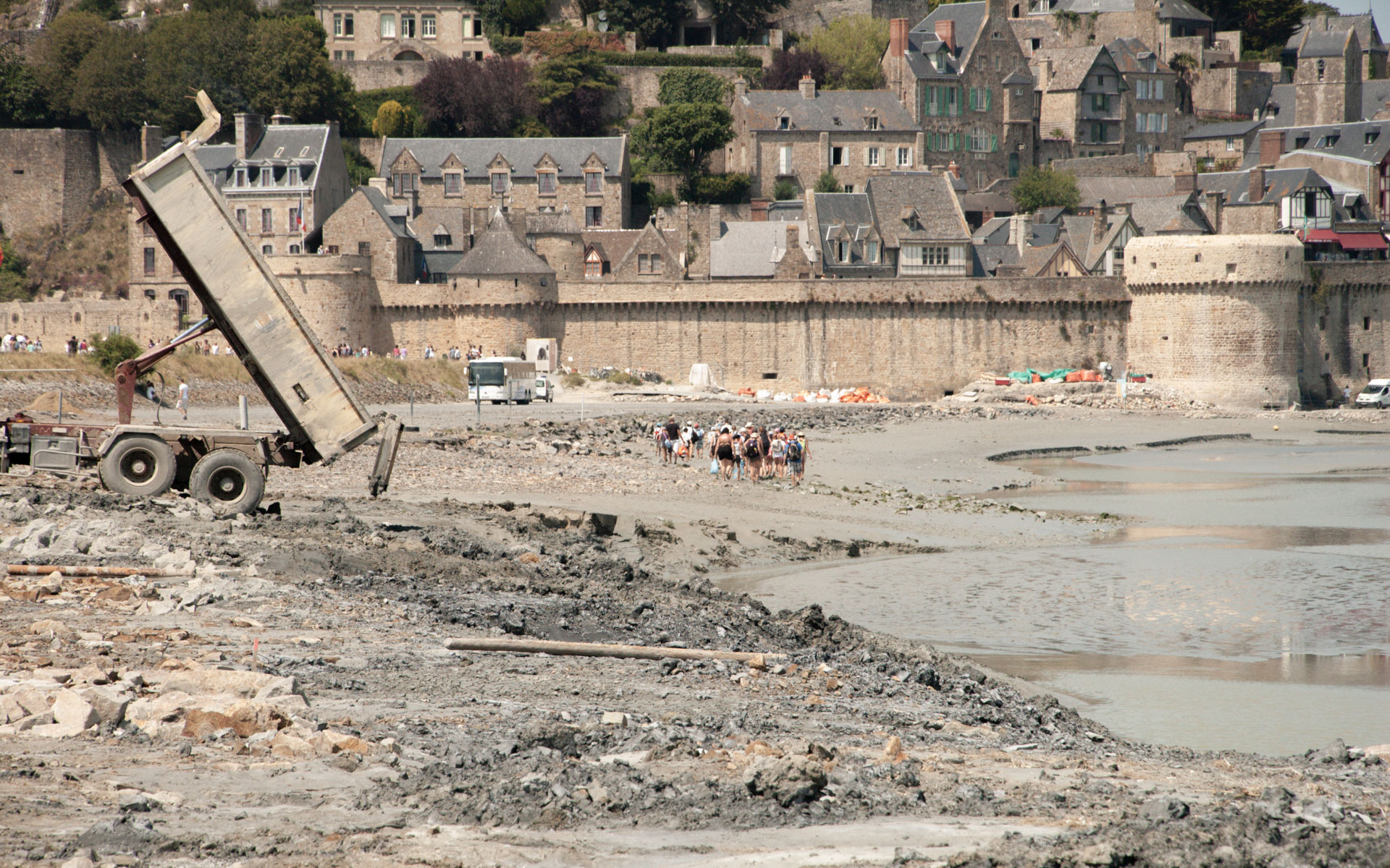
Mont Saint-Michel and its bay were declared a UNESCO World Heritage site in 1979. Perched on a rock in the bay, the medieval village of Mont Saint-Michel and its monastery represent a major cultural heritage on one of France’s most visited sites.
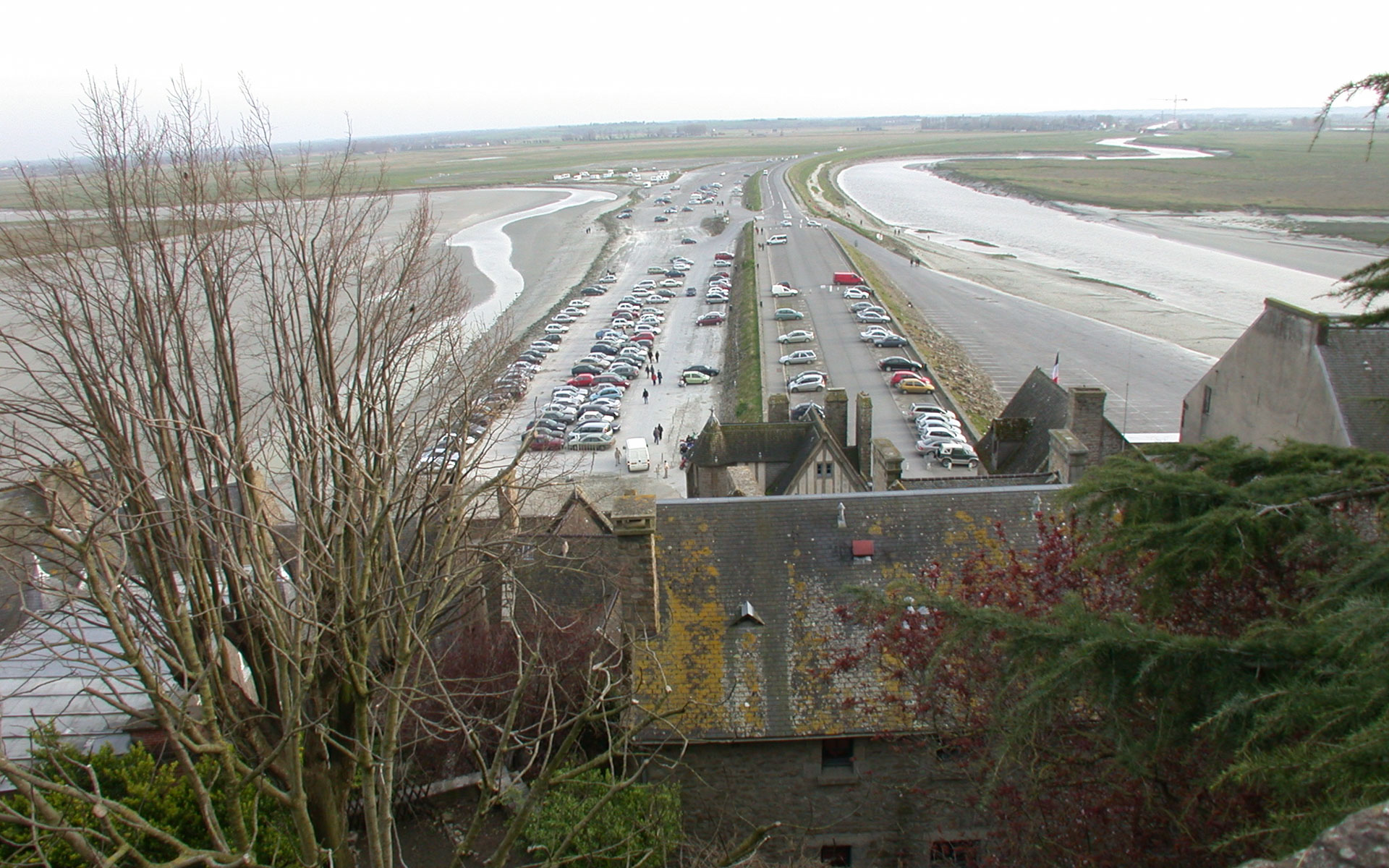
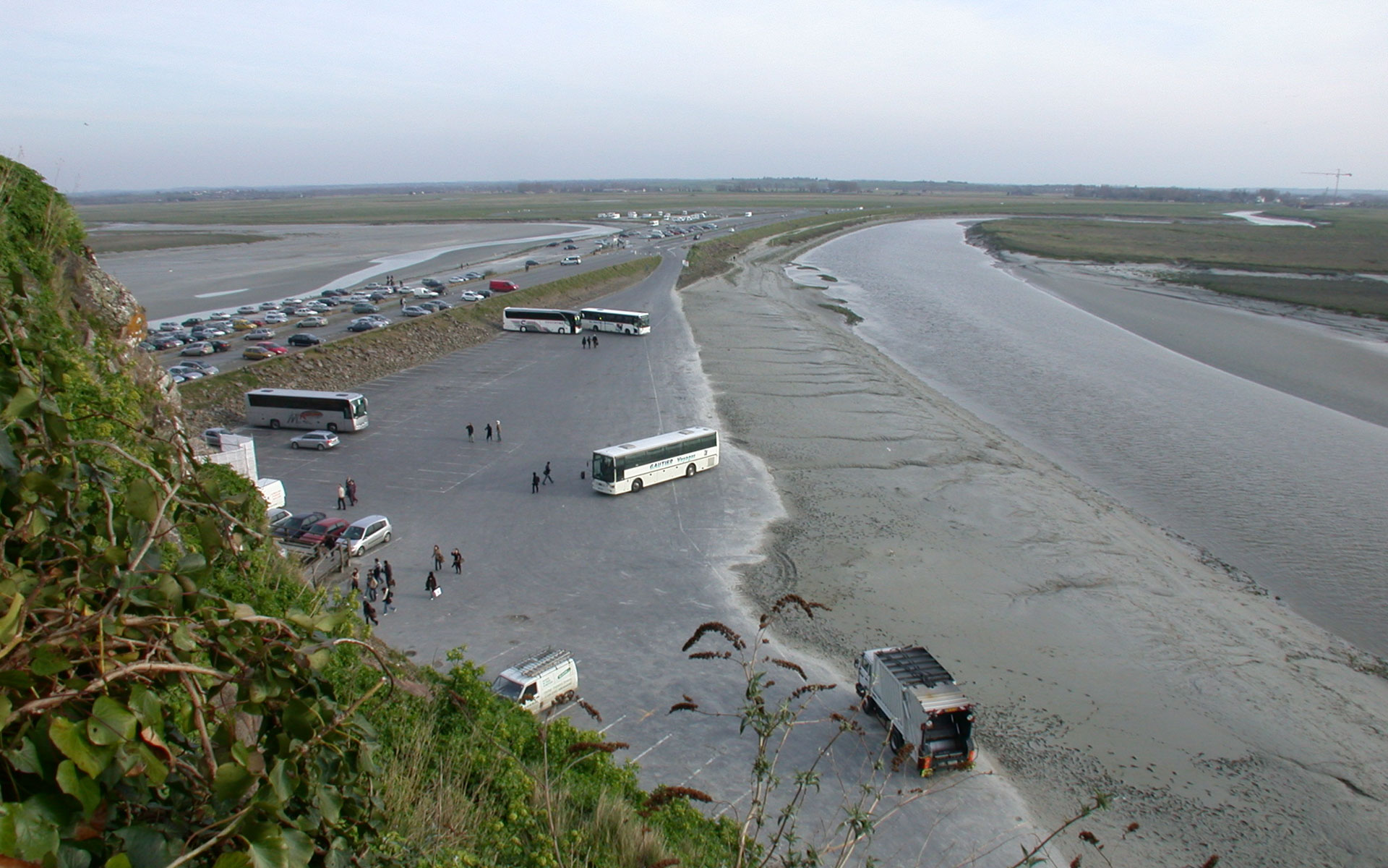
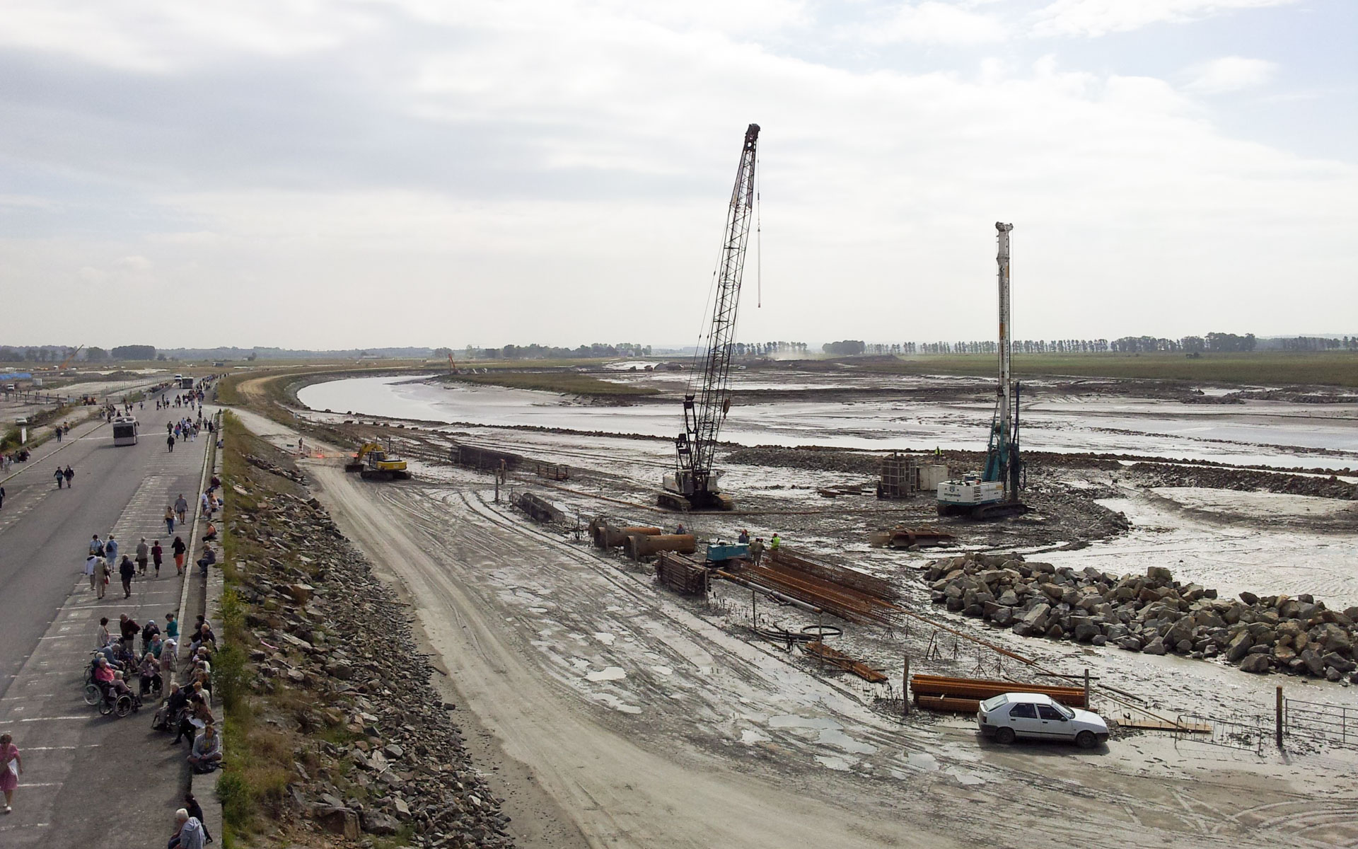
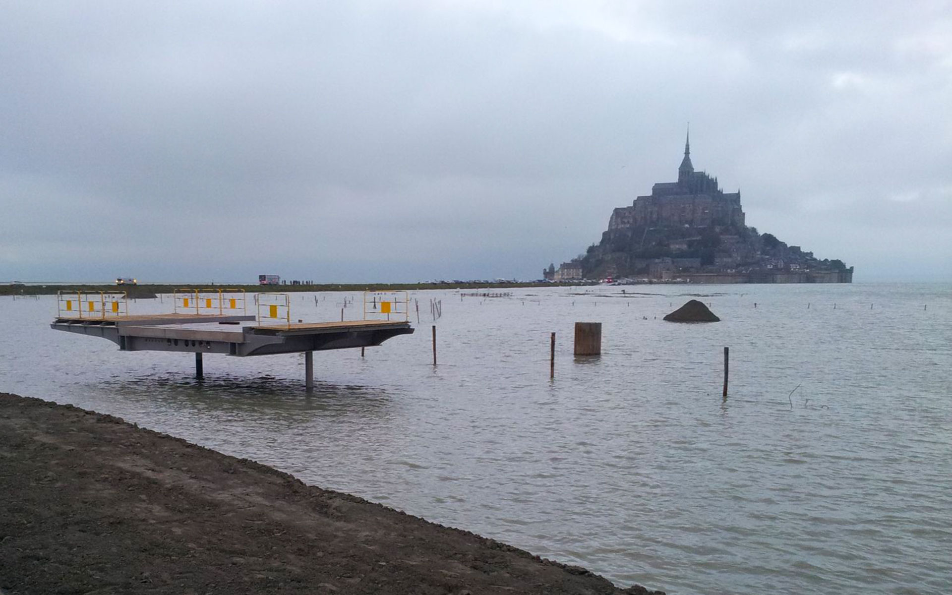
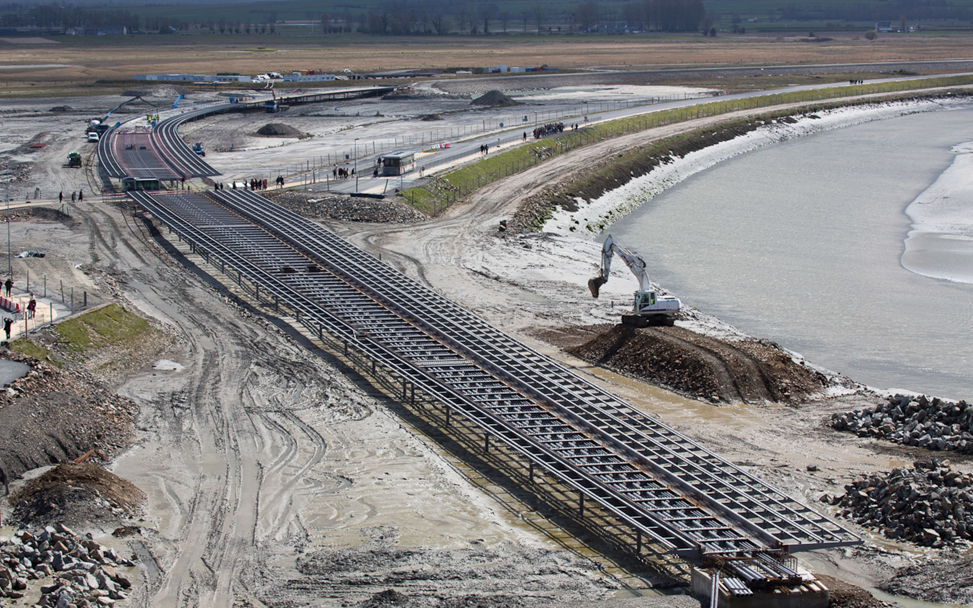
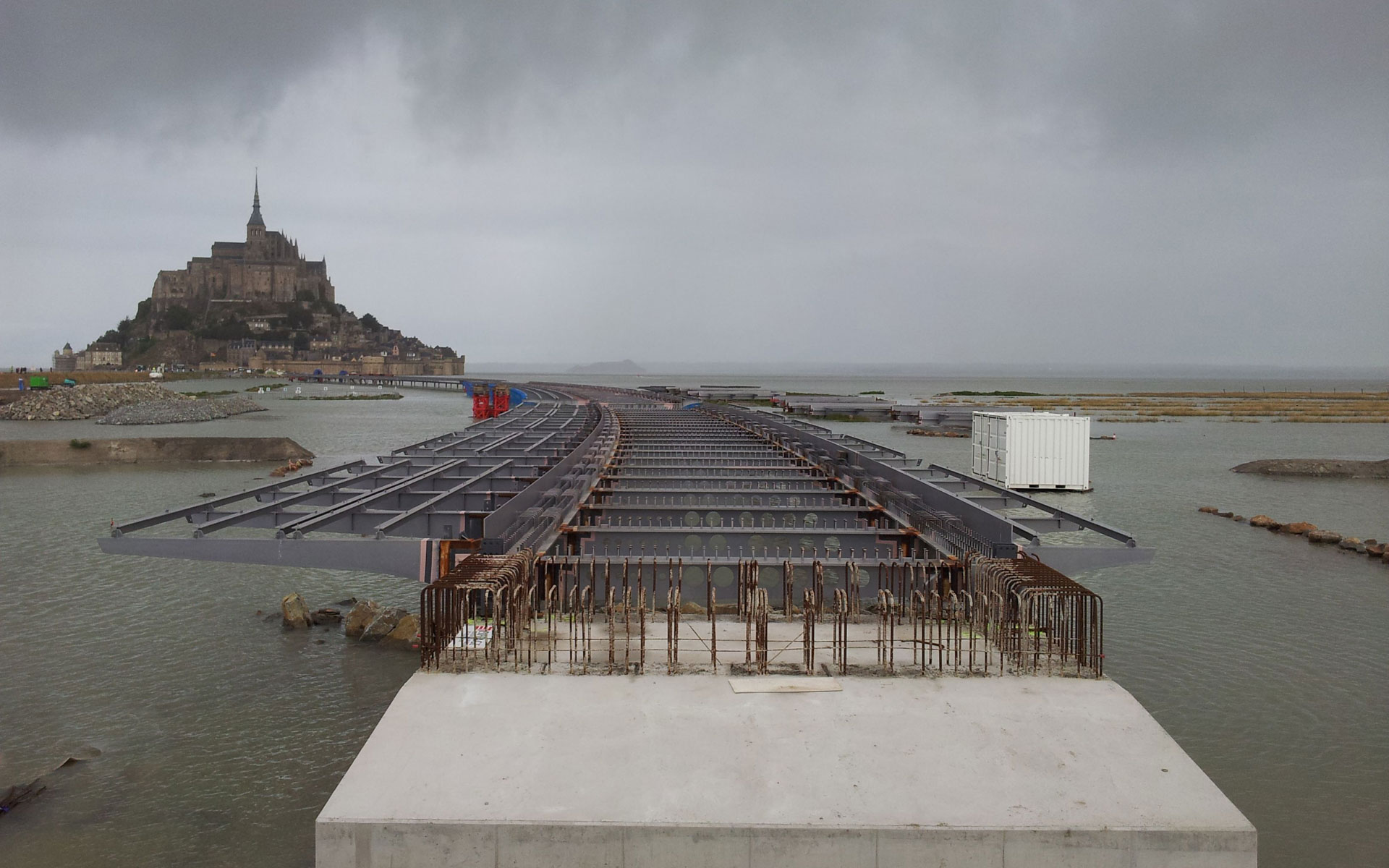
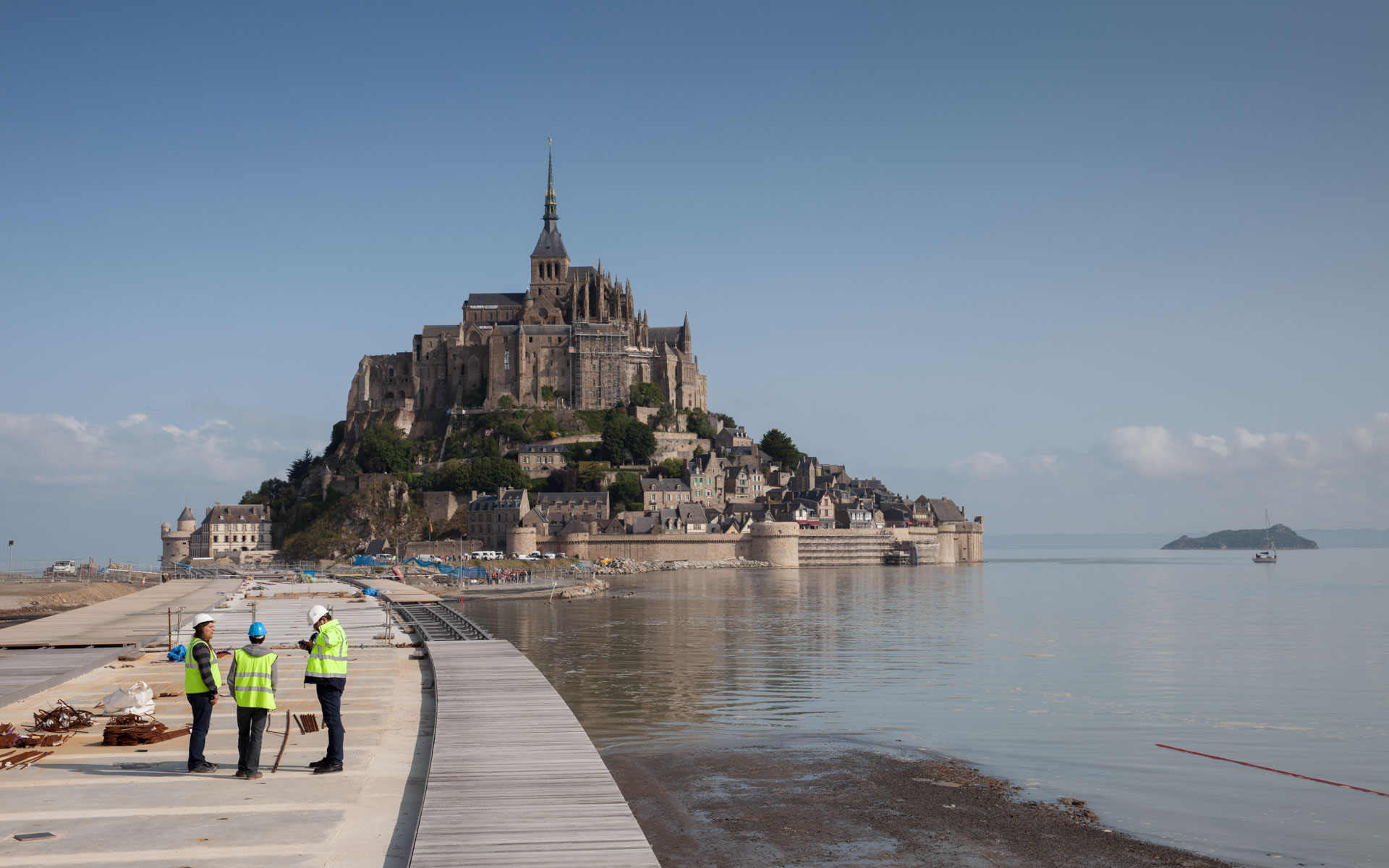
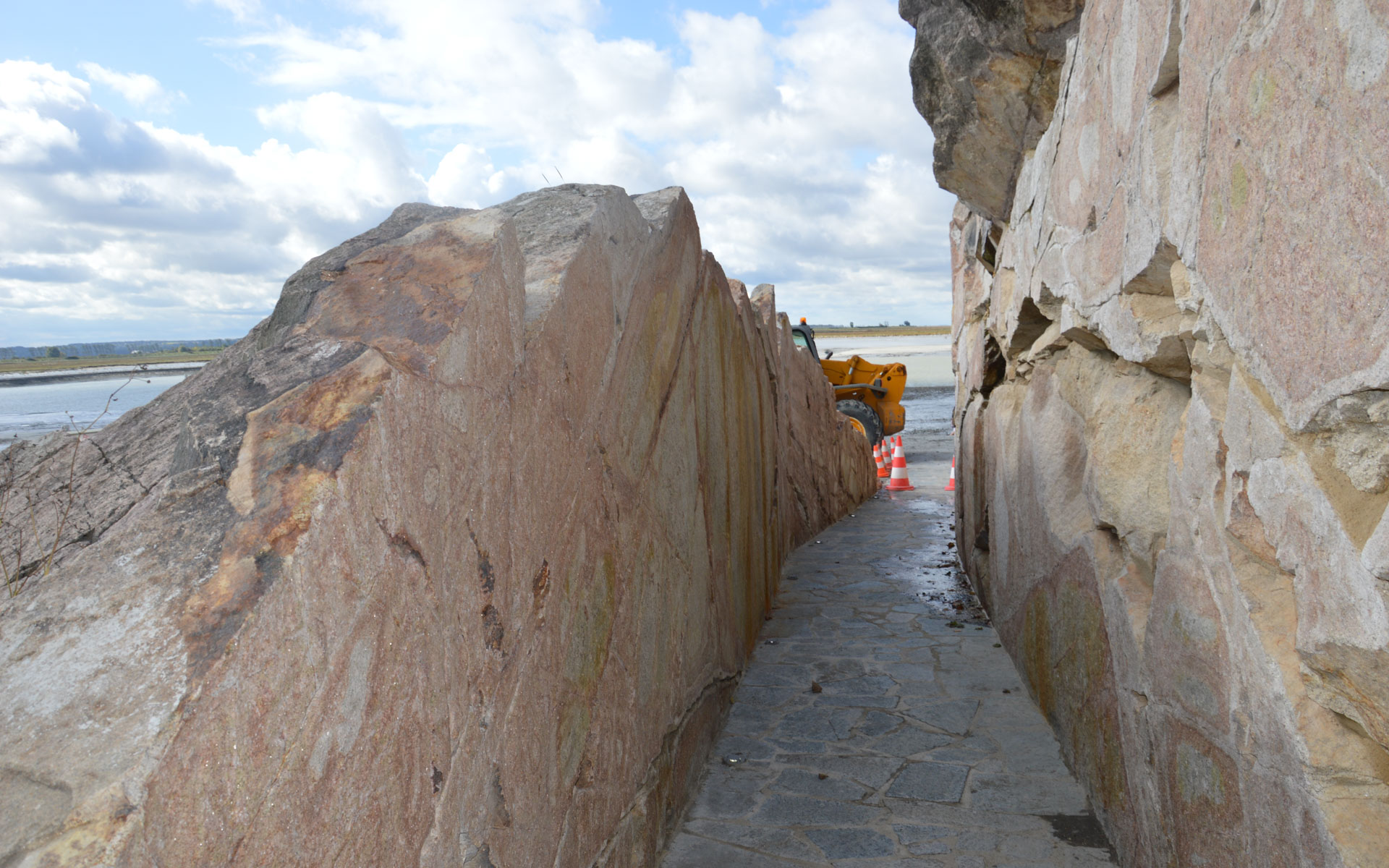
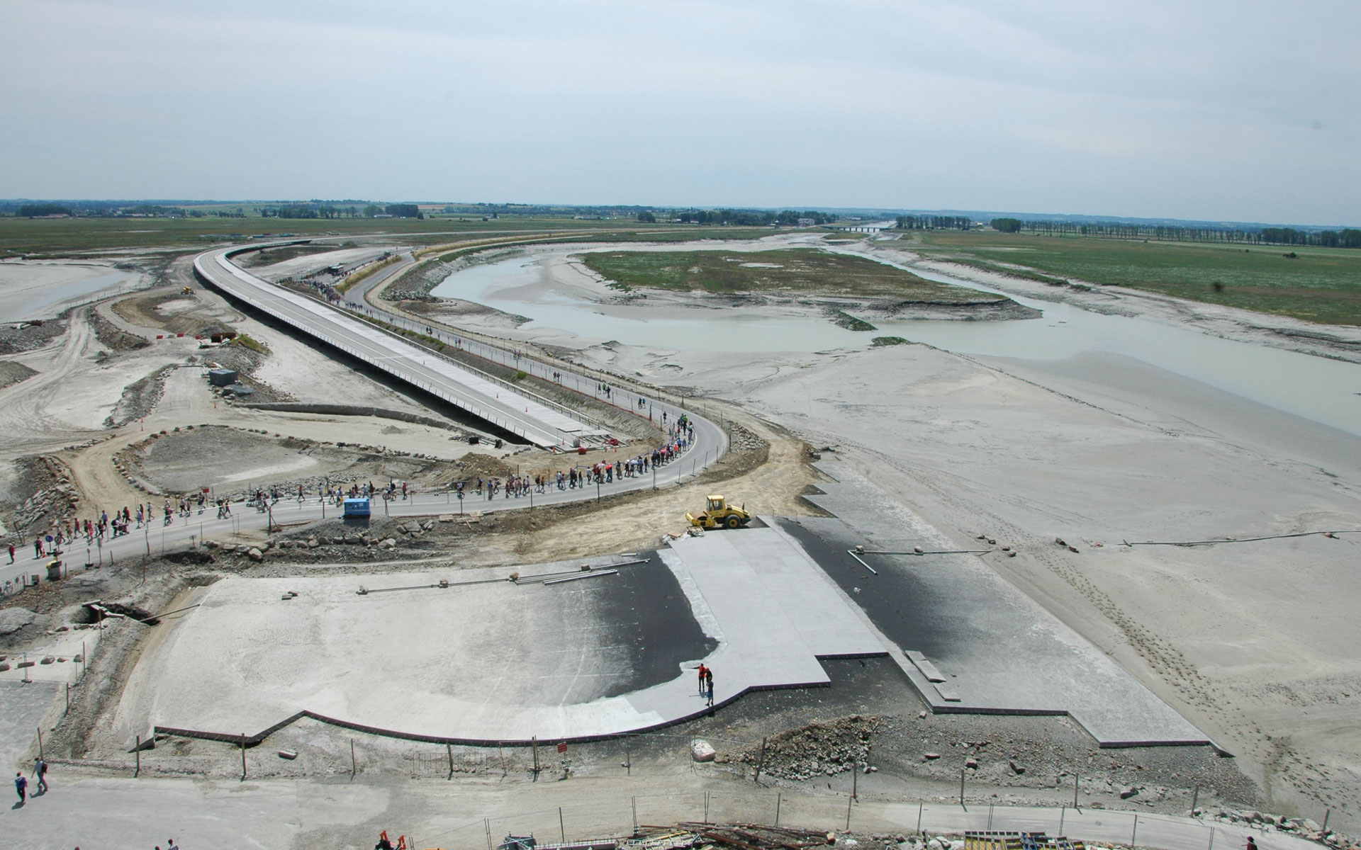
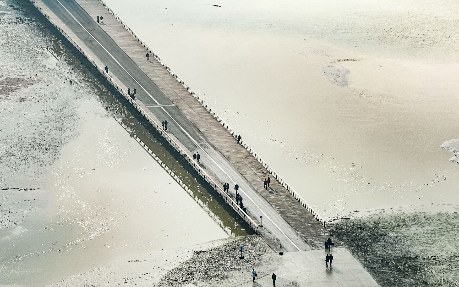
In 1879, a dam exceeding the highest tide level was constructed to ensure safe and permanent access for visitors. This dam partially obstructed the Couesnan River, leading to increased sedimentation, bringing the mainland closer to the island. To allow water to flow freely, a new dike and a 756-meter-long footbridge will replace the existing road dam and preserve the insularity of Mont Saint-Michel.
The New Road Dike and Footbridge – A Delicate and Subtle Response
In this sensitive context, human intervention is complex.
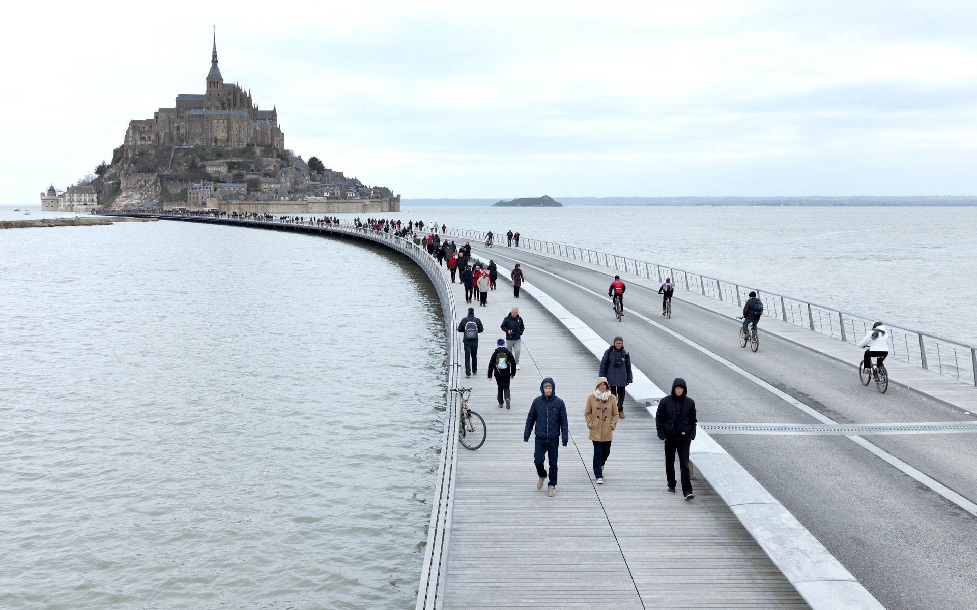
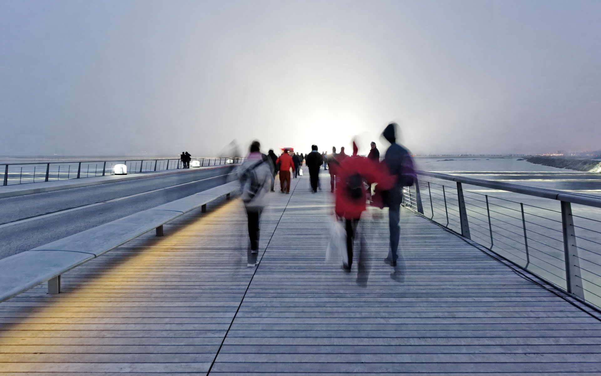
The pathway provides a walkway for pedestrians and carries shuttles to make the monument accessible to all. It also serves as a communal road, meeting all the requirements of a standard road.
Project Objectives
The project’s goals are its integration into the site, maximum transparency for views, and especially ensuring the smooth flow of water to maintain insularity and accelerate desilting.
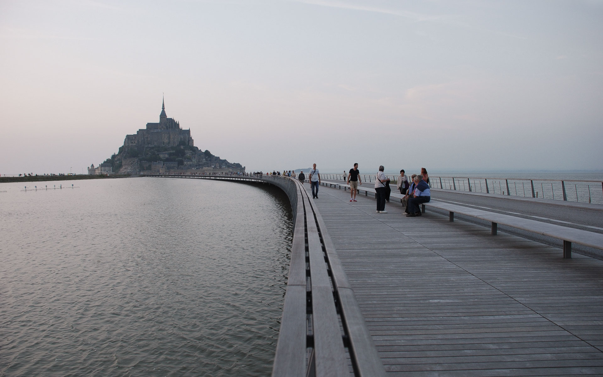
The Response – “Walking on Water”
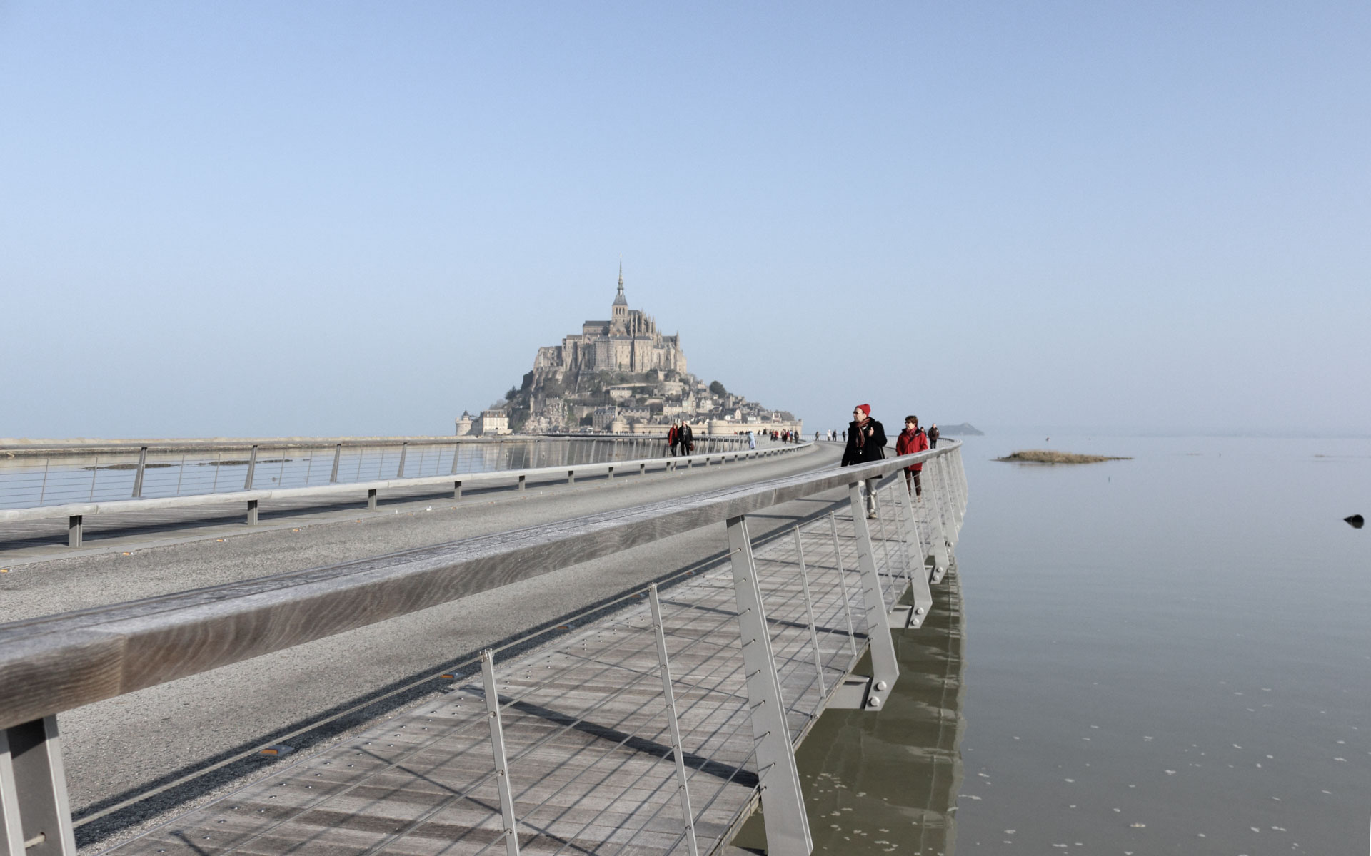
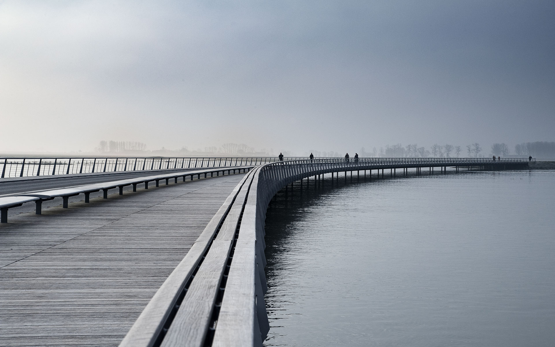
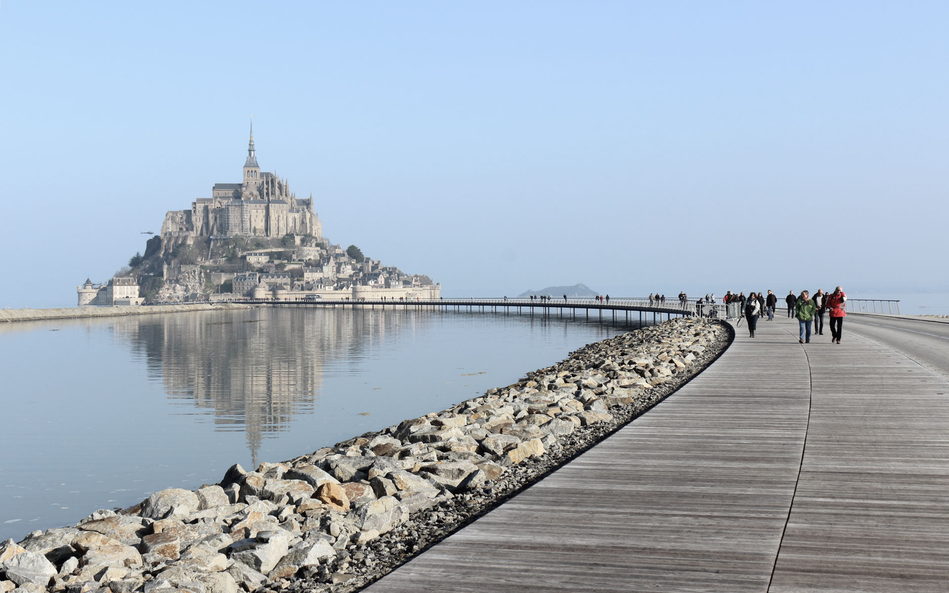
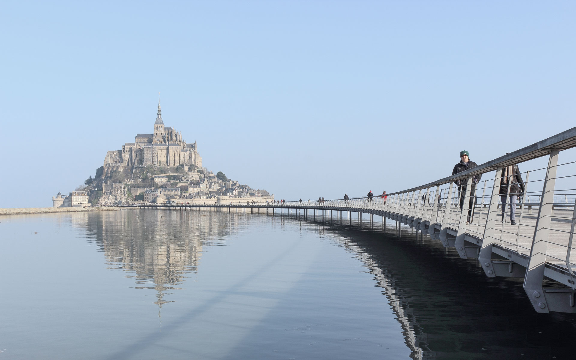
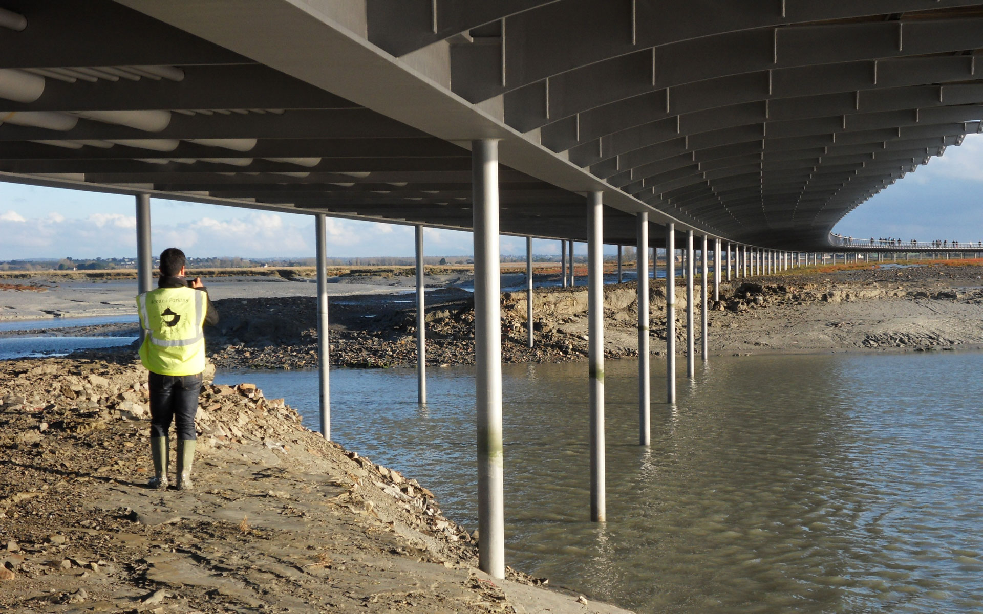
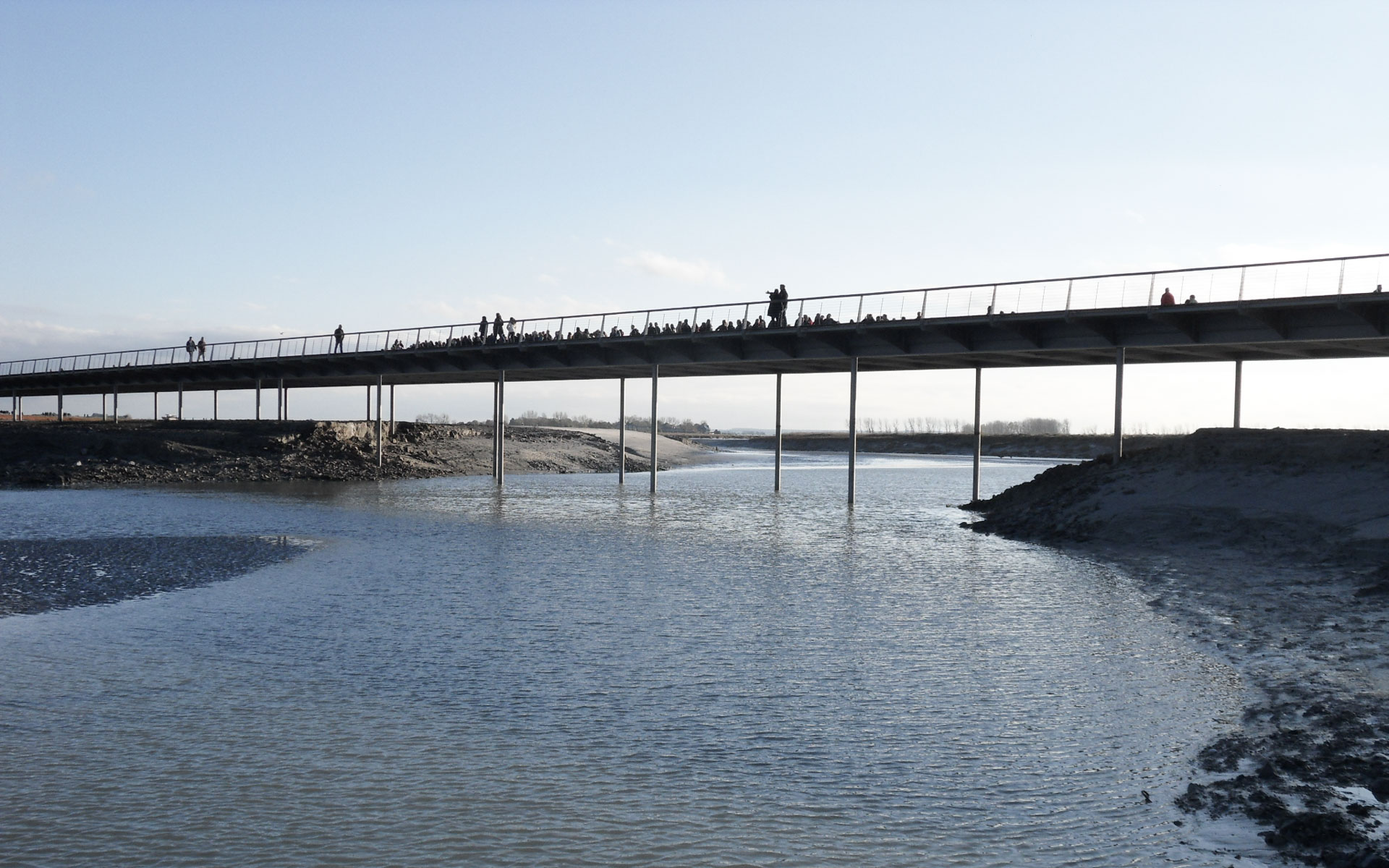
The access structure extends into the bay with its curved geometry embracing the bay and accompanying pedestrians. Following lines drawn by the water, it offers multiple perspectives around Mont Saint-Michel. Perfectly horizontal, the bridge’s deck line blends into the horizon.
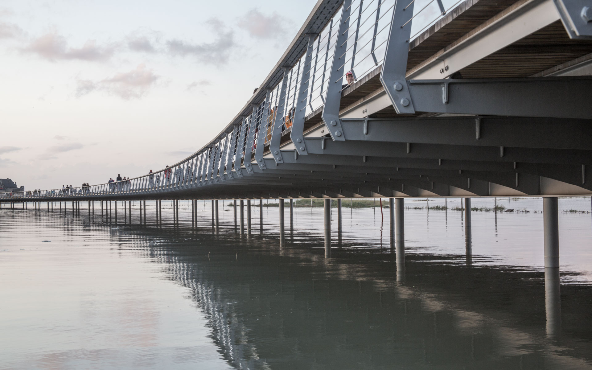
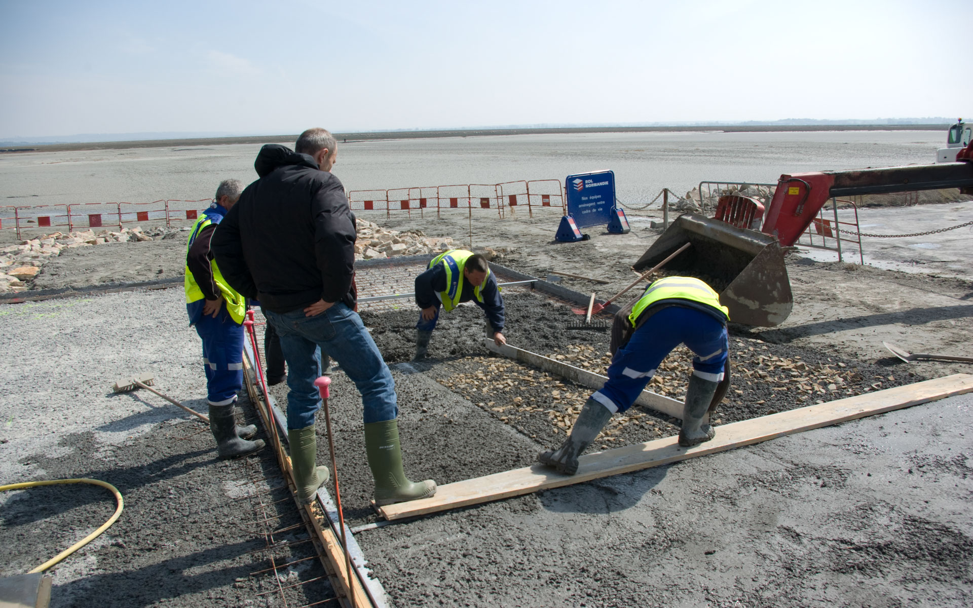
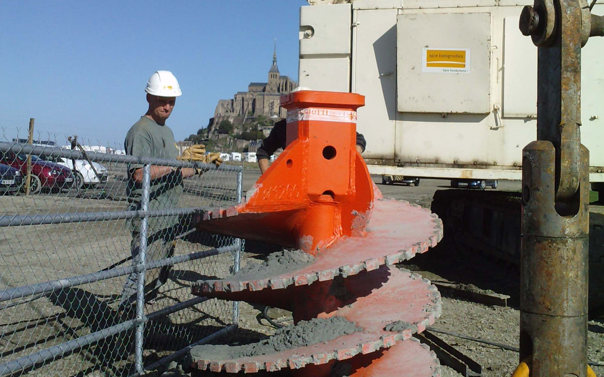
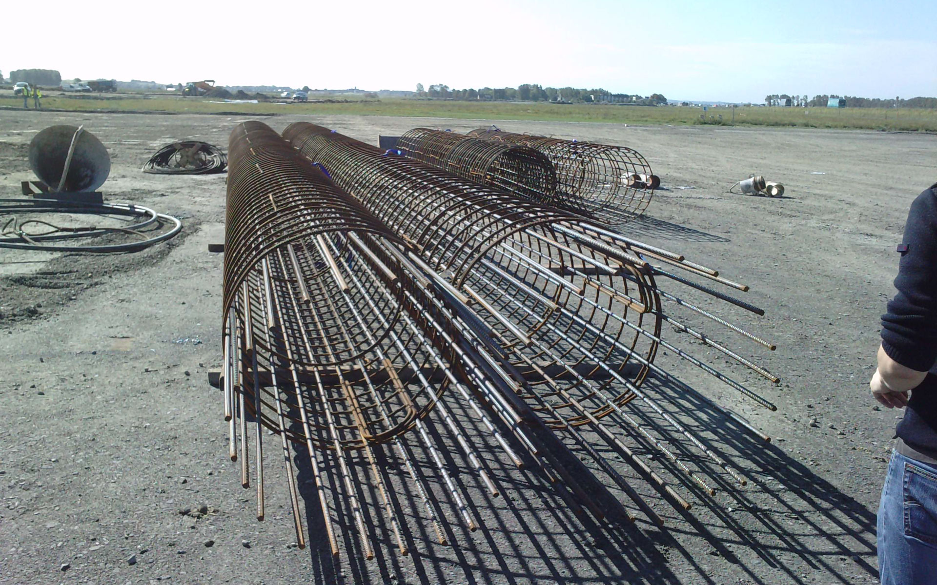
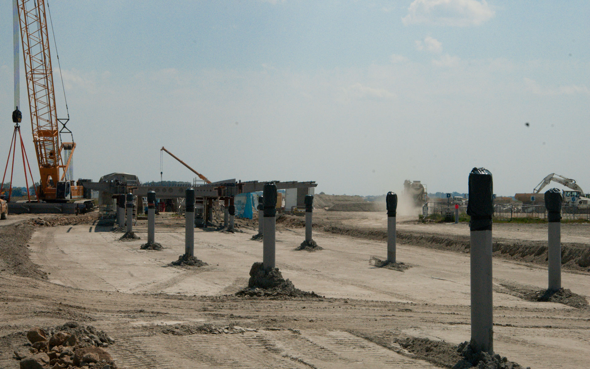
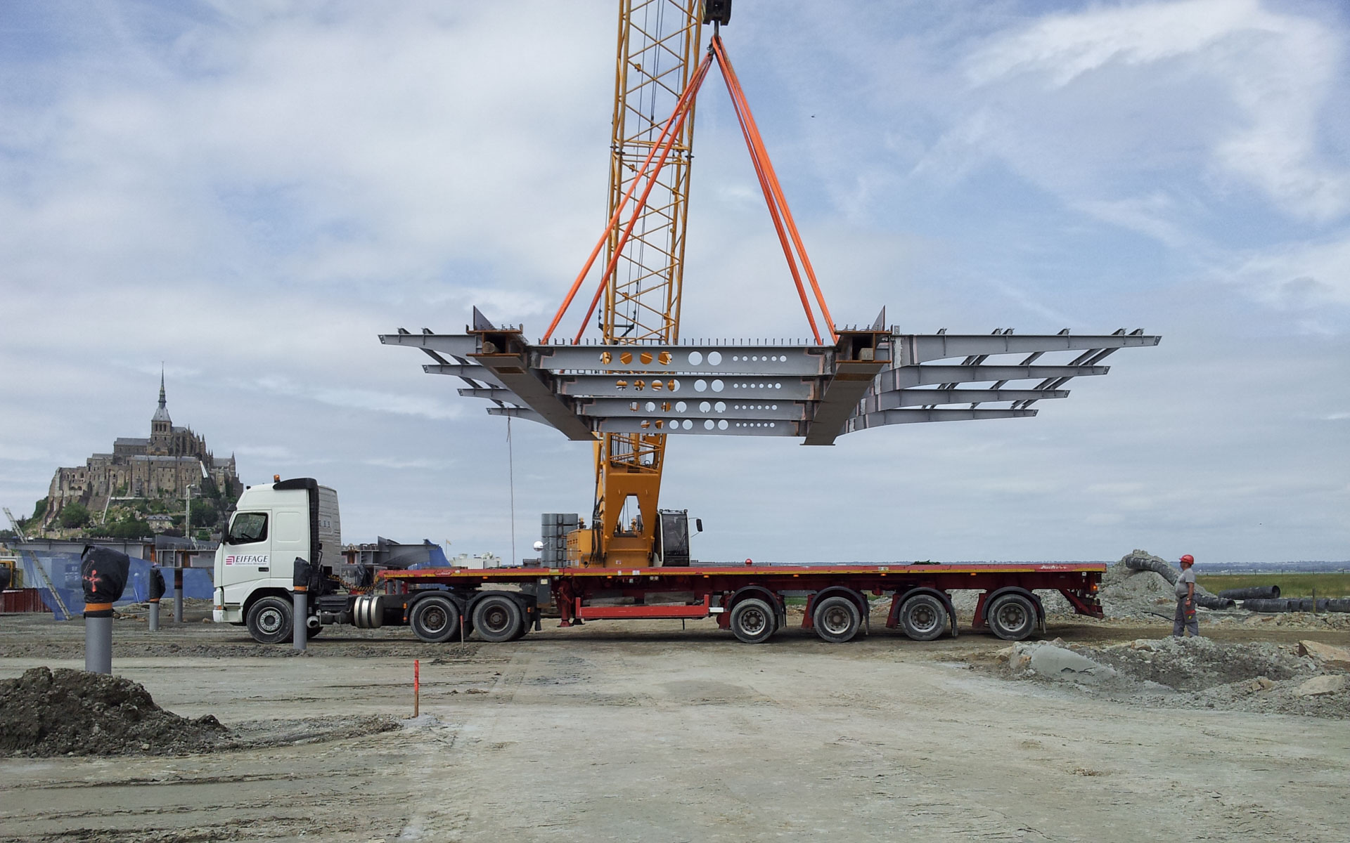
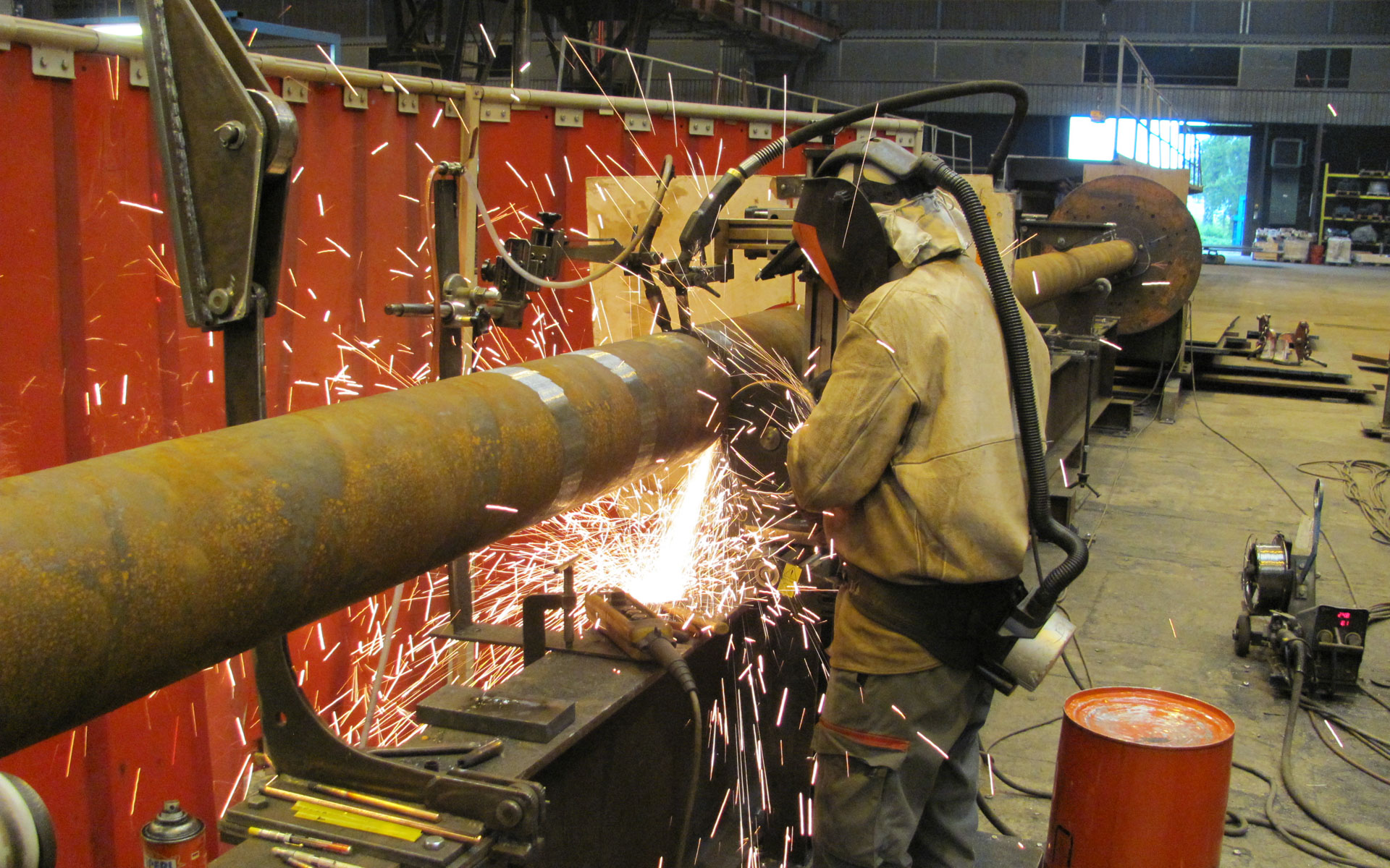
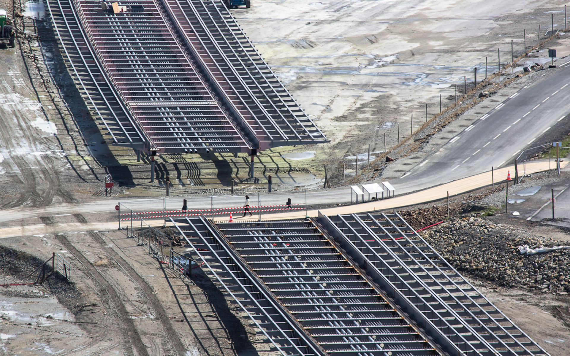
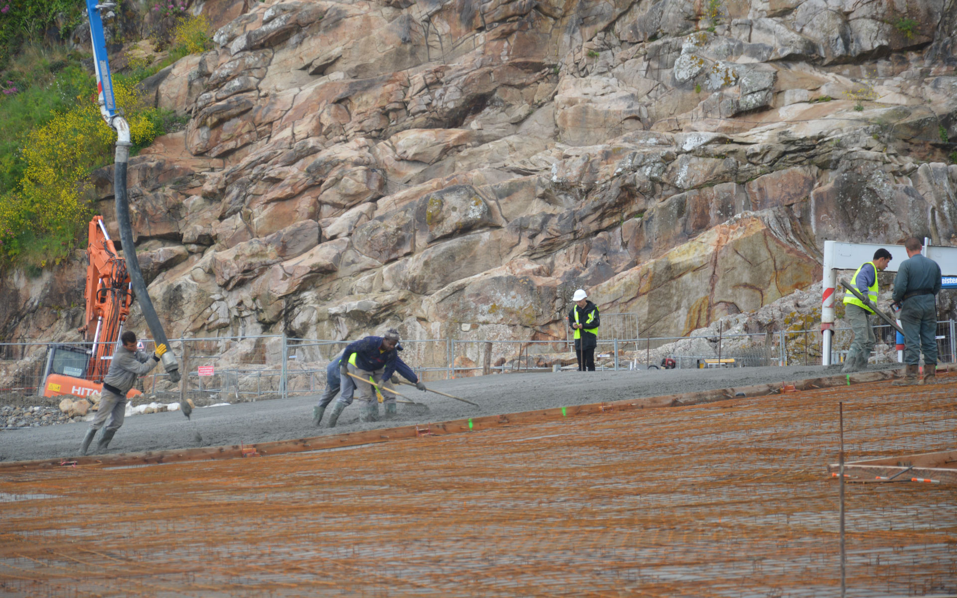
The deck, a blade on the water, is supported by slender pillars. Optimization of thickness is achieved through close spacing of the pillars every 12 meters. They are embedded at the top and bottom. The top embedding is achieved through welding with the deck structure, while the bottom embedding involves anchoring the pillar in 30-meter-deep concrete piles founded on shale.
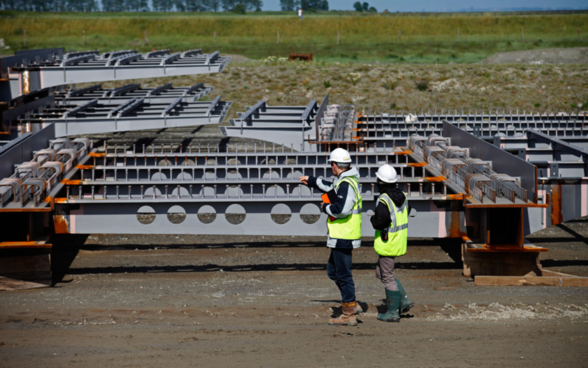
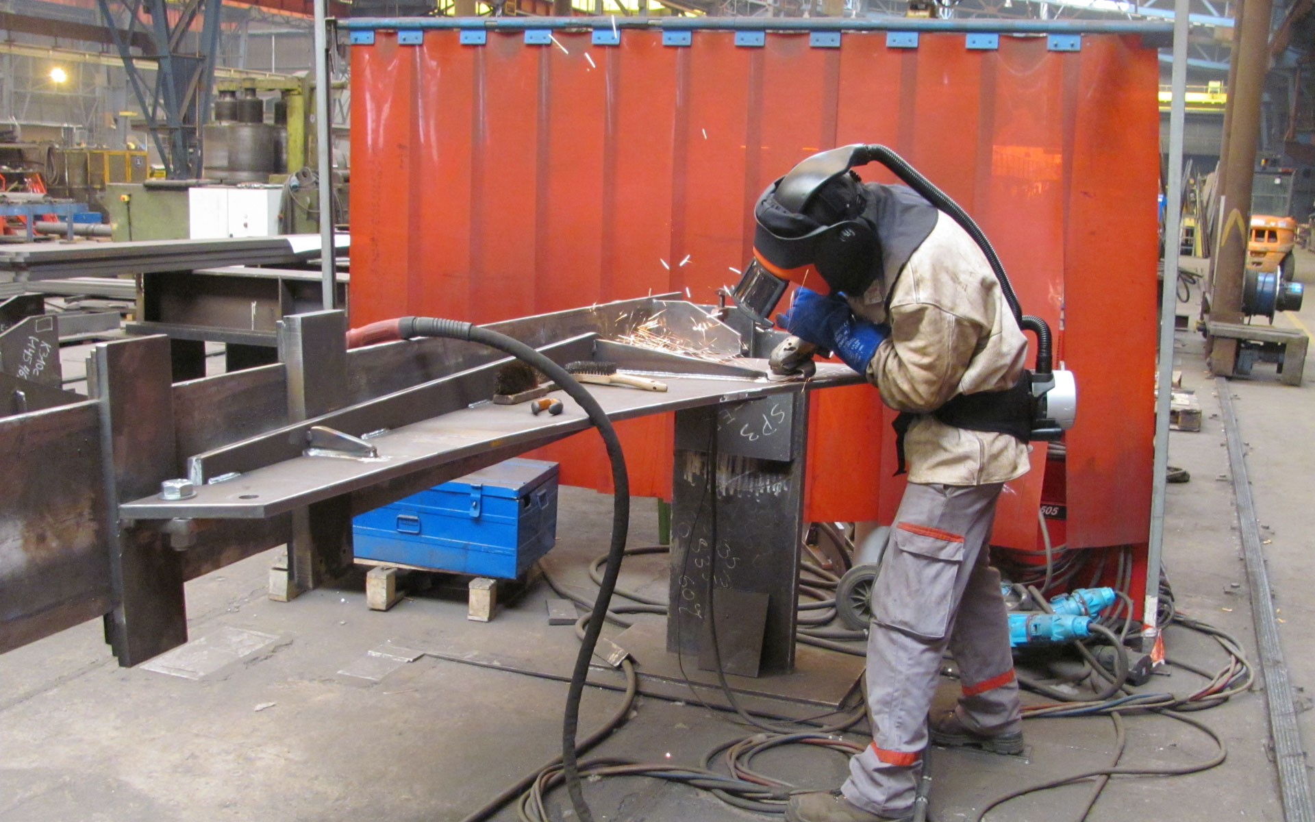
The structure consists of horizontal and vertical elements. The purity of the design is achieved through the absence of diagonals or cross-bracing. The horizontality of the deck contrasts with the verticality of the monument, emphasizing the uniqueness of each structure. The slender pillars, with a diameter of 250 mm, require tube thicknesses ranging from 40 to 60 mm, depending on the pillar’s length.
More than just a crossing, the arrangement of the pillars resembles a promenade, like a pier extending into the open sea. The series of pillars responds to the vastness of the site, avoiding noticeable overlaps.
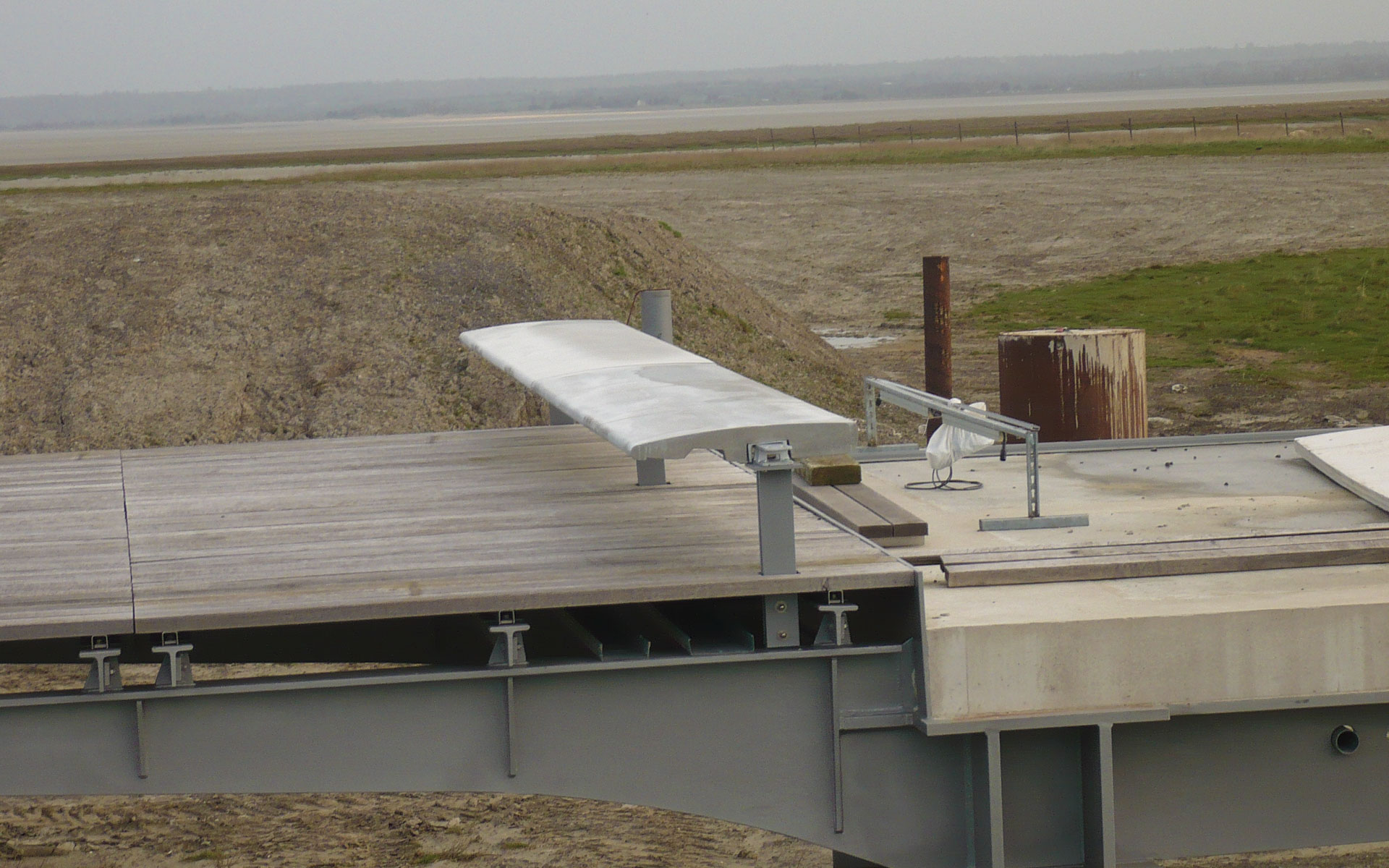
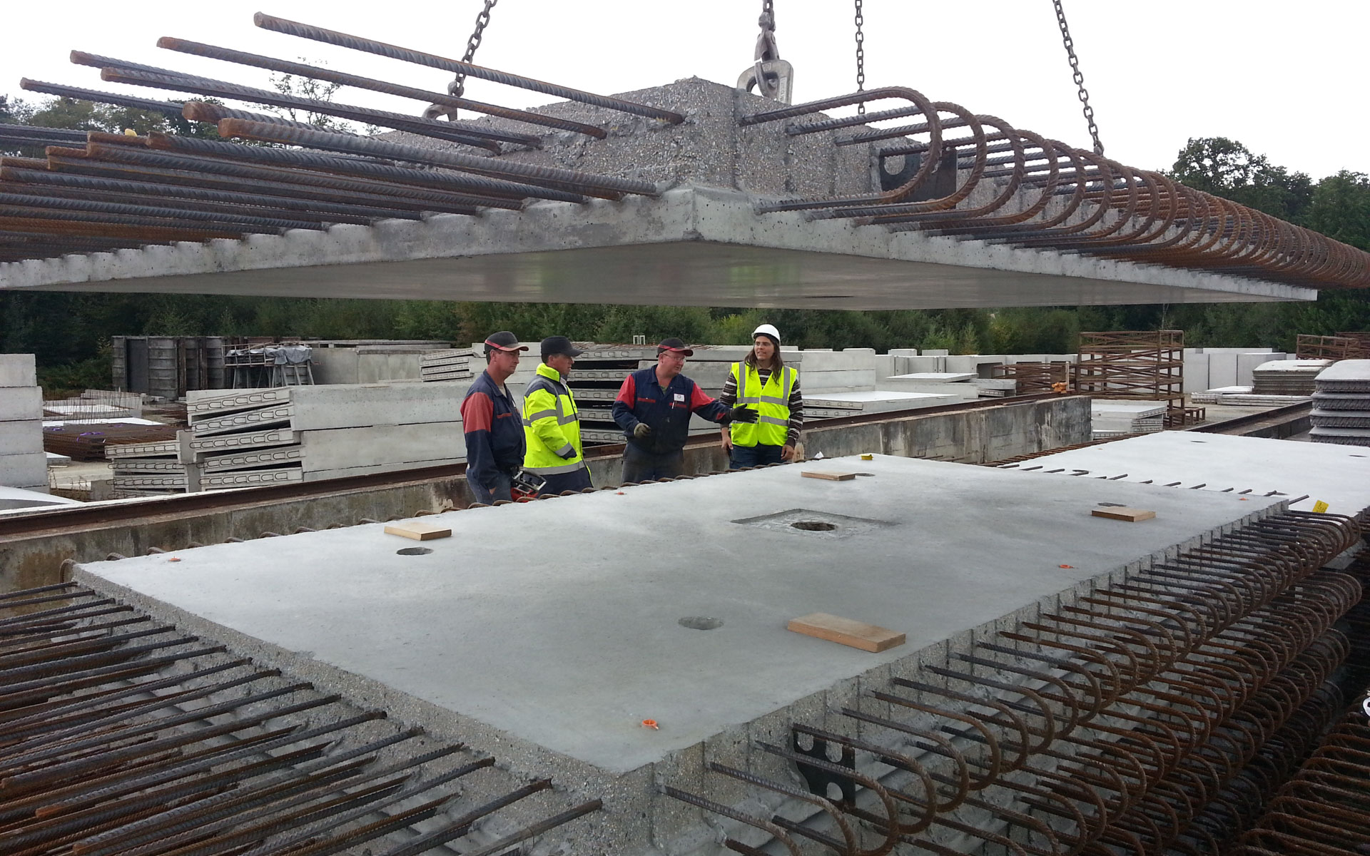
The road is situated in the central part. A transverse steel structure supports a concrete deck. Wide cantilevers on the sides accommodate pedestrians on a wooden deck supported by metal brackets in a T-shape.
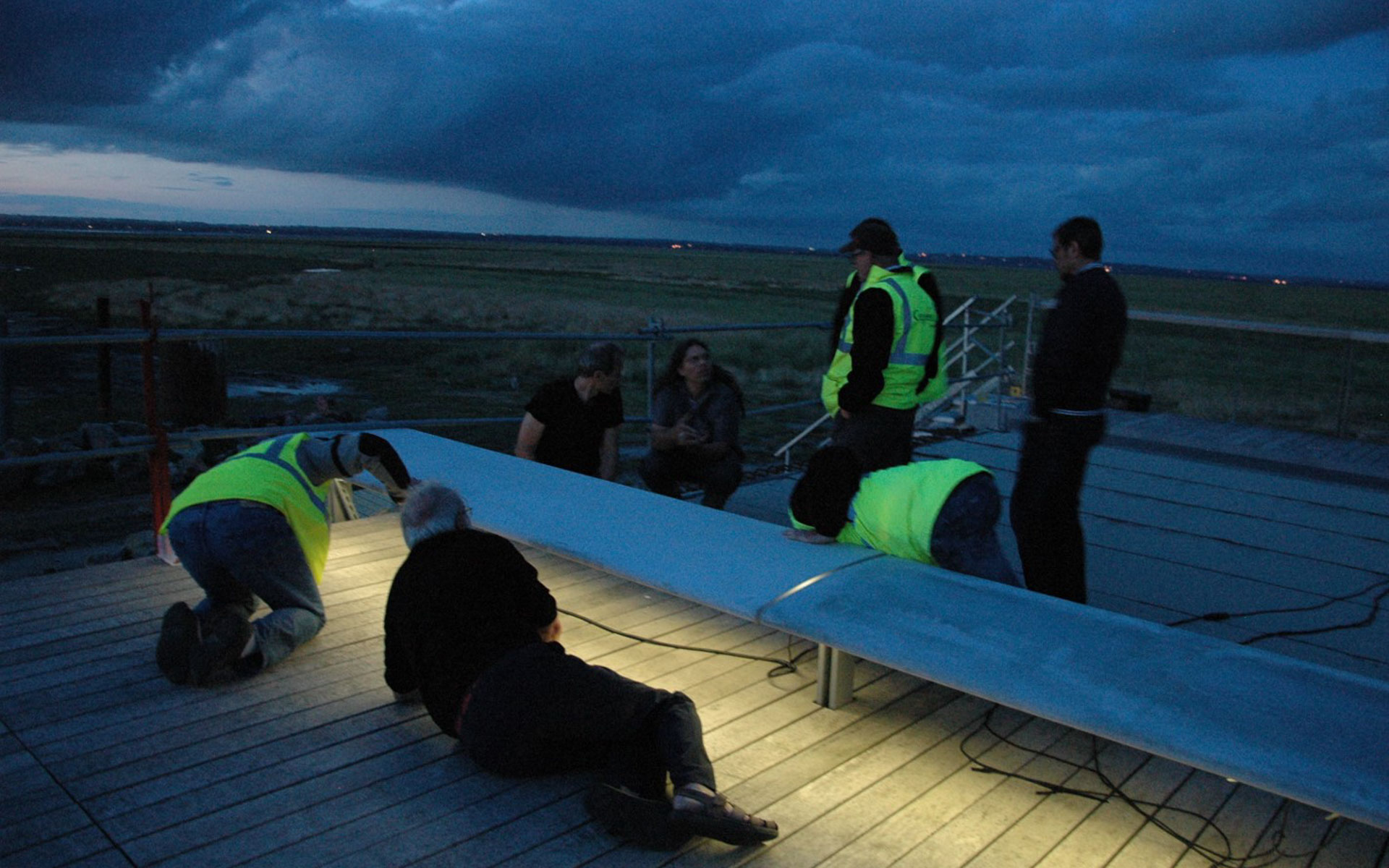
Double pillars every 120 meters mark the end of continuous sections. Temperature-induced expansion is addressed here, considering the flexibility of the slender pillars. The guardrails and the support for a continuous bench separating the roadway and the pedestrian walkway are also made of steel.
The color of the structure, a metallic gray, expresses its materiality. It reflects light and underscores the lightness of the structure.
Key Figures
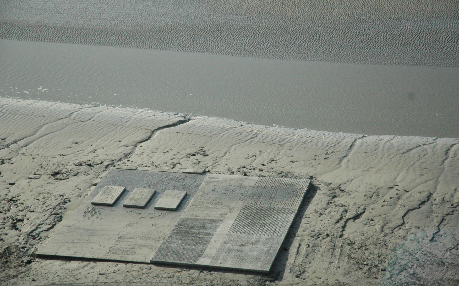
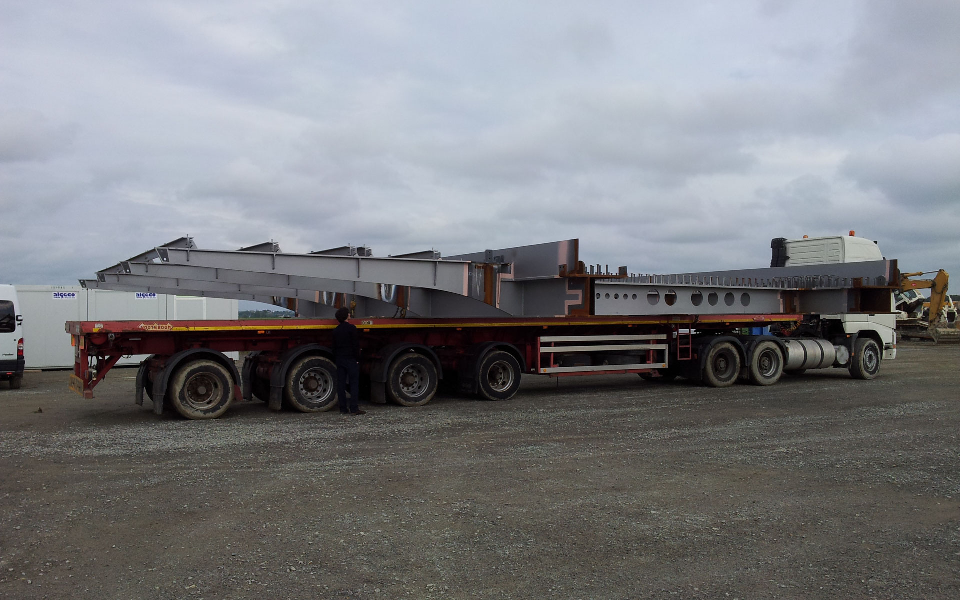
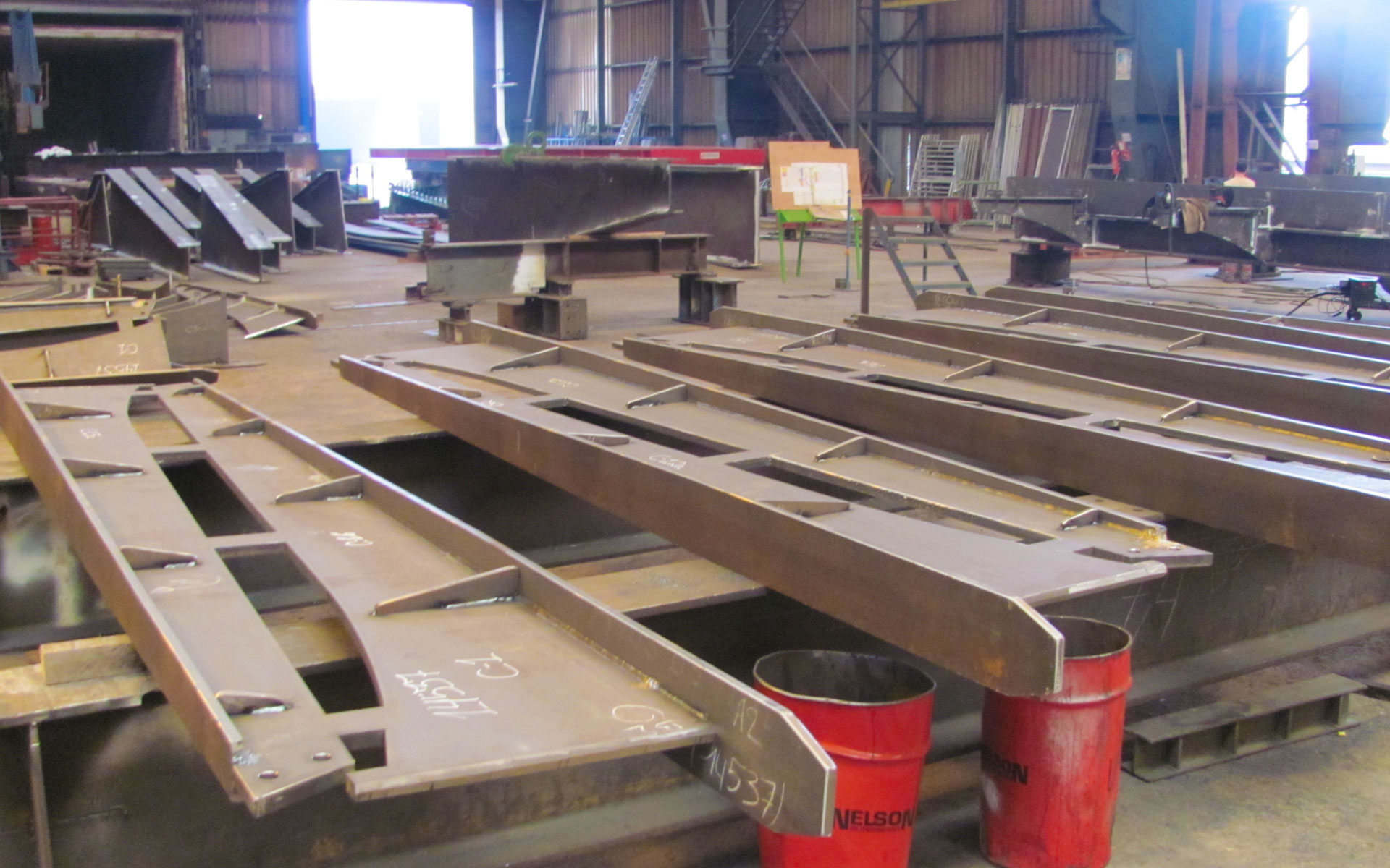
The access structure consists of a land-based portion measuring 1,200 meters in length, slightly elevated above the natural terrain above the highest waters. It continues as a jetty, supported by 134 pillars with an outer diameter of 250 mm and a thickness of 40 or 60 mm depending on the length. The pillar lengths vary between 10 meters and 12 meters, with approximately 3 meters embedded in the lower part. The total weight of steel used is 335 tons.
The Deck
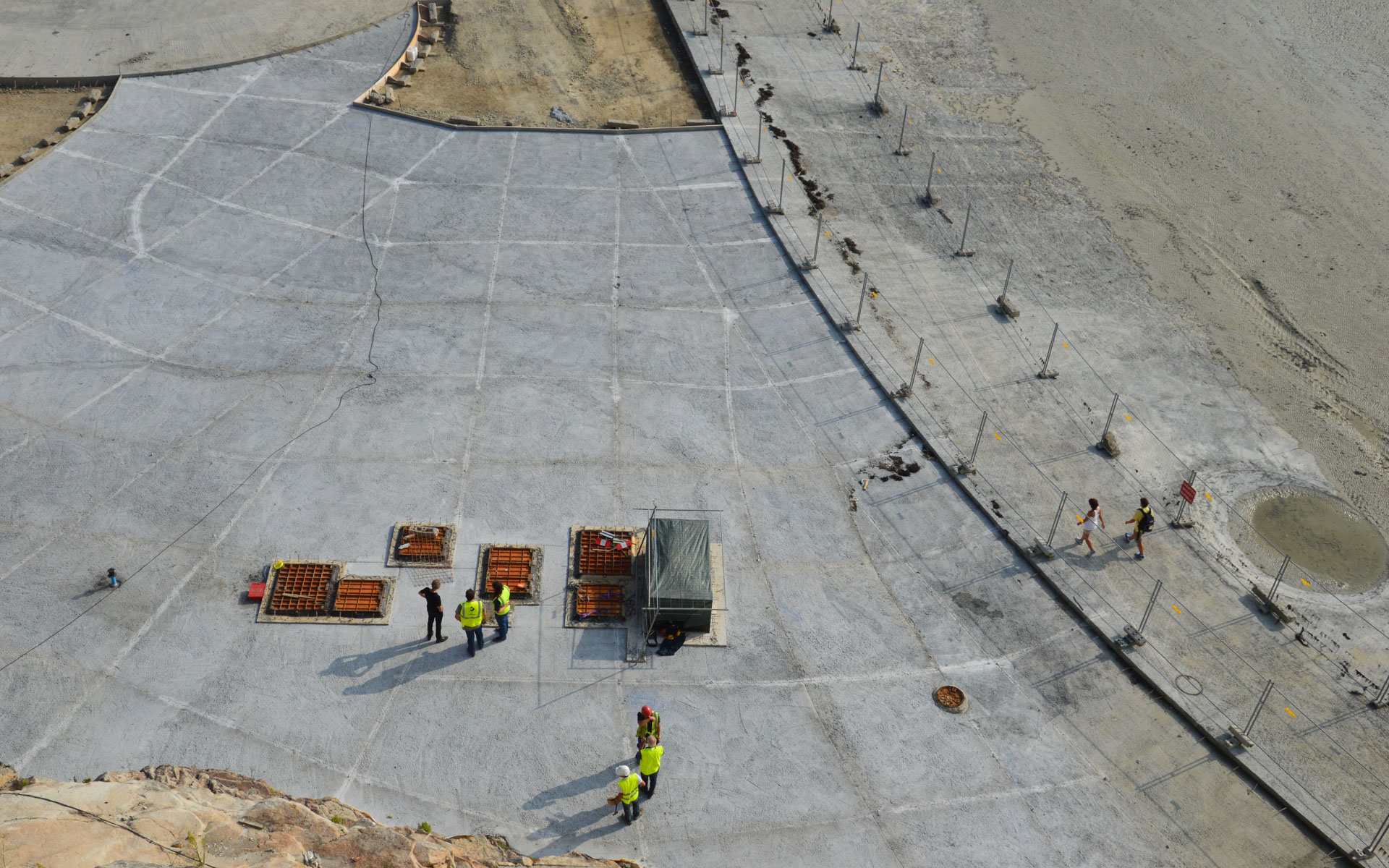
The main framework (box girders, crossbeams) is 756 meters long, 6.5 meters wide in the central section, and 8.5 meters wide at the terminal. The total weight is 1265 tons.
The lateral pedestrian pathways are supported by brackets, 4.5 meters long on the west and 1.5 meters long on the east. These profiles have a variable cross-section and are reconstructed with a total weight of 250 tons.
The wooden decking, made of oak, is supported by longitudinal T-shaped beams.
Lead Architect: Dietmar Feichtinger Architectes, mandate
Engineers: Sbp
Subcontractors :Aia Management, assistant site supervision engineering and planning
Geotechnical studies: Antéa
Electricity, water supply and evacuation : Inex
Hydraulic studies Artélia
Geotechnical follow up: Technosol
Wood Construction Award Region Lower Normandy 2015
National Wood Construction Award 2015
Trophées Eiffel Steel Construction Award 2015
Equerre d’Argent 2015, category bridges
“Walking on Water”
Creating a new access point to a cultural monument and one of Europe’s most remarkable landscapes presents a rare challenge in bridge design.
The estuary of the Couesnon River and the bay surrounding Mont Saint-Michel impress with the immensity of the site, its vastness, the beauty of the light, and the colors of the natural elements. The dramatic tidal range of 14 meters exposes the forces of nature and offers diverse landscapes—a vast beach stretching to the horizon alternates with a flooded bay, with only the Mont serving as an island.
Human intervention in the context of Mont Saint-Michel is delicate. The creation of a tide-protected access route aims to provide a safe pathway for visitors while allowing the natural flow of water around the island. This radical change enhances the magic of the place. The minimal slope of the estuary and one of the world’s largest tidal differences accentuate the phenomenon: “the sea rises at the speed of a galloping horse,” as Victor Hugo described it.
The Contrasting Natural Site and Human Impact
Mont Saint-Michel and its bay were declared a UNESCO World Heritage site in 1979. Perched on a rock in the bay, the medieval village of Mont Saint-Michel and its monastery represent a major cultural heritage on one of France’s most visited sites.
In 1879, a dam exceeding the highest tide level was constructed to ensure safe and permanent access for visitors. This dam partially obstructed the Couesnan River, leading to increased sedimentation, bringing the mainland closer to the island. To allow water to flow freely, a new dike and a 756-meter-long footbridge will replace the existing road dam and preserve the insularity of Mont Saint-Michel.
The New Road Dike and Footbridge – A Delicate and Subtle Response
In this sensitive context, human intervention is complex.
The pathway provides a walkway for pedestrians and carries shuttles to make the monument accessible to all. It also serves as a communal road, meeting all the requirements of a standard road.
Project Objectives
The project’s goals are its integration into the site, maximum transparency for views, and especially ensuring the smooth flow of water to maintain insularity and accelerate desilting.
The Response – “Walking on Water”
The access structure extends into the bay with its curved geometry embracing the bay and accompanying pedestrians. Following lines drawn by the water, it offers multiple perspectives around Mont Saint-Michel. Perfectly horizontal, the bridge’s deck line blends into the horizon.
The deck, a blade on the water, is supported by slender pillars. Optimization of thickness is achieved through close spacing of the pillars every 12 meters. They are embedded at the top and bottom. The top embedding is achieved through welding with the deck structure, while the bottom embedding involves anchoring the pillar in 30-meter-deep concrete piles founded on shale.
The structure consists of horizontal and vertical elements. The purity of the design is achieved through the absence of diagonals or cross-bracing. The horizontality of the deck contrasts with the verticality of the monument, emphasizing the uniqueness of each structure. The slender pillars, with a diameter of 250 mm, require tube thicknesses ranging from 40 to 60 mm, depending on the pillar’s length.
More than just a crossing, the arrangement of the pillars resembles a promenade, like a pier extending into the open sea. The series of pillars responds to the vastness of the site, avoiding noticeable overlaps.
The road is situated in the central part. A transverse steel structure supports a concrete deck. Wide cantilevers on the sides accommodate pedestrians on a wooden deck supported by metal brackets in a T-shape.
Double pillars every 120 meters mark the end of continuous sections. Temperature-induced expansion is addressed here, considering the flexibility of the slender pillars. The guardrails and the support for a continuous bench separating the roadway and the pedestrian walkway are also made of steel.
The color of the structure, a metallic gray, expresses its materiality. It reflects light and underscores the lightness of the structure.
Key Figures
The access structure consists of a land-based portion measuring 1,200 meters in length, slightly elevated above the natural terrain above the highest waters. It continues as a jetty, supported by 134 pillars with an outer diameter of 250 mm and a thickness of 40 or 60 mm depending on the length. The pillar lengths vary between 10 meters and 12 meters, with approximately 3 meters embedded in the lower part. The total weight of steel used is 335 tons.
The Deck
The main framework (box girders, crossbeams) is 756 meters long, 6.5 meters wide in the central section, and 8.5 meters wide at the terminal. The total weight is 1265 tons.
The lateral pedestrian pathways are supported by brackets, 4.5 meters long on the west and 1.5 meters long on the east. These profiles have a variable cross-section and are reconstructed with a total weight of 250 tons.
The wooden decking, made of oak, is supported by longitudinal T-shaped beams.
Lead Architect: Dietmar Feichtinger Architectes, mandate
Engineers: Sbp
Subcontractors :Aia Management, assistant site supervision engineering and planning
Geotechnical studies: Antéa
Electricity, water supply and evacuation : Inex
Hydraulic studies Artélia
Geotechnical follow up: Technosol